Mawai, Hilauli
Mawai | |
|---|---|
Village | |
 Map showing Mawai (#645) in Hilauli CD block | |
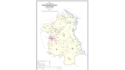
 Mawai Location in Uttar Pradesh, India | |
| Coordinates: 26°23′12″N 80°59′43″E / 26.386631°N 80.99528°ECoordinates: 26°23′12″N 80°59′43″E / 26.386631°N 80.99528°E[1] | |
| Country India | |
| State | Uttar Pradesh |
| District | Unnao |
| Area | |
| • Total | 24.89 km2 (9.61 sq mi) |
| Population (2011)[2] | |
| • Total | 14,690 |
| • Density | 590/km2 (1,500/sq mi) |
| Languages | |
| • Official | Hindi |
| Time zone | UTC+5:30 (IST) |
| Vehicle registration | UP-35 |

Mawai is a village in Hilauli block of Unnao district, Uttar Pradesh, India.[2] As of 2011, its population is 14,690, in 2,734 households, and it has 8 primary schools and one medical clinic.[2] It hosts a regular market and has a post office.[2]
History[]
Mawai was founded by Man Singh, a Dikhit Chhatri from in what is now Banda district.[3] It was previously the site of a Bhar fort, which Man Singh conquered and razed to the ground.[3] He received the land as a jagir from the king in Delhi and founded a village on the site, which he named after himself.[3] His descendants founded various around Mawai, and for a long time they also held in the village.[3] At some point, the Dikhits gifted the village to an ancestor of one Sheikh Mansur.[3]
At the turn of the 20th century, Mawai was described as a large, dispersed settlement in the southeastern part of the pargana of Maurawan.[3] It lay off the main roads and had no bazar, and it was mostly significant for its large size.[3] The 1901 census recorded its population as 4,363 people, including a Muslim minority of 256.[3]
The 1961 census recorded Mawai as comprising 19 hamlets, with a total population of 5,940 people (2,854 male and 2,636 female), in 965 households and 860 physical houses.[4] The area of the village was given as 6,503 acres.[4] It had a medical practitioner and post office then.[4] There were two grain mills, one small establishment producing edible fats/oils, two miscellaneous food processing facilities, one small manufacturer of ammunition, fireworks, or other explosives, one bicycle repair shop, two places making clocks and/or watches, and two small manufacturers of jewellery or precious metal objects.[4] It hosted a biweekly haat on Wednesdays and Thursdays where grain and vegetables were the main items of trade, and its average attendance was around 250 people at the time.[4]
References[]
- ^ Search for "Mawai" here https://geonames.nga.mil/namesgaz/. Missing or empty
|title=(help) - ^ a b c d e "Census of India 2011: Uttar Pradesh District Census Handbook - Unnao, Part A (Village and Town Directory)". Census 2011 India. pp. 373–89. Retrieved 11 July 2021.
- ^ a b c d e f g h Nevill, H.R. (1903). Unao: A Gazetteer, Being Volume XXXVIII Of The District Gazetteers Of The United Provinces Of Agra And Oudh. Allahabad: Government Press. pp. 202–3. Retrieved 11 July 2021.
- ^ a b c d e Census 1961: District Census Handbook, Uttar Pradesh (37 - Unnao District) (PDF). Lucknow. 1965. pp. 158, cxiv-cxv of section "Purwa Tehsil", cxxvi–cxxvii. Retrieved 11 July 2021.
- Villages in Unnao district