Jhalotar
Jhalotar | |
|---|---|
Village | |
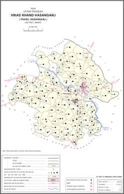 Map showing Jhalotar (#934) in Hasanganj CD block | |
 Jhalotar Location in Uttar Pradesh, India | |
| Coordinates: 26°42′N 80°39′E / 26.700°N 80.650°ECoordinates: 26°42′N 80°39′E / 26.700°N 80.650°E[1] | |
| Country India | |
| State | Uttar Pradesh |
| District | Unnao |
| Area | |
| • Total | 1.777 km2 (0.686 sq mi) |
| Population (2011)[2] | |
| • Total | 1,990 |
| • Density | 1,100/km2 (2,900/sq mi) |
| Languages | |
| • Official | Hindi |
| Time zone | UTC+5:30 (IST) |
| Vehicle registration | UP-35 |

Jhalotar is a village in Hasanganj block of Unnao district, Uttar Pradesh, India.[2] It is located just to the west of the Mohan-Ajgain road, near a lake called Kundra Samundar.[1] It hosts a weekly haat and has one primary school and no healthcare facilities.[2] Drinking water is provided by hand pump.[2] As of 2011, the population of the village is 1,990, in 319 households.[2]
History[]
According to tradition, the spot now occupied by Jhalotar was once a dhak jungle where a faqir named Mushtaq Shah lived.[1] A Chamar man also built a house nearby, made a clearing, and started a village called "Jhali" here; the name later became Jhalotar.[1] Jhalotar is listed in the Ain-i-Akbari as the seat of a pargana, and at some point the Subahdar of Awadh built a fort here.[1] In 1770, , the minister of the Nawab of Awadh, was granted a jagir in the Jhalotar pargana, which was split off to become a new pargana based at Ajgain.[1] The two parganas were merged again under the British Raj.[1] At the turn of the 20th century, Jhalotar was described as a small village with a population of 682.[1] It hosted a small market once per week.[1]
The 1961 census recorded Jhalotar as comprising 1 hamlet, with a total population of 854 (445 male and 409 female), in 164 households and 153 physical houses.[3] The area of the village was given as 432 acres.[3]
References[]
- ^ a b c d e f g h i Nevill, H.R. (1903). Unao: A Gazetteer, Being Volume XXXVIII Of The District Gazetteers Of The United Provinces Of Agra And Oudh. Allahabad: Government Press. pp. 188–91. Retrieved 2 July 2021.
- ^ a b c d e f "Census of India 2011: Uttar Pradesh District Census Handbook - Unnao, Part A (Village and Town Directory)". Census 2011 India. pp. 204–36. Retrieved 2 July 2021.
- ^ a b Census 1961: District Census Handbook, Uttar Pradesh (37 - Unnao District) (PDF). Lucknow. 1965. pp. liv-lv of section "Hasanganj Tehsil". Retrieved 2 July 2021.
This article about a location in Uttar Pradesh is a stub. You can help Wikipedia by . |
- Villages in Unnao district
- Uttar Pradesh geography stubs