Pahasa
Pahasa
Pahāsa | |
|---|---|
Village | |
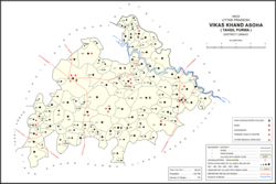 Map showing Pahasa (#448) in Asoha CD block | |
 Pahasa Location in Uttar Pradesh, India | |
| Coordinates: 26°34′07″N 80°55′03″E / 26.568666°N 80.917446°ECoordinates: 26°34′07″N 80°55′03″E / 26.568666°N 80.917446°E[1] | |
| Country India | |
| State | Uttar Pradesh |
| District | Unnao |
| Area | |
| • Total | 3.78 km2 (1.46 sq mi) |
| Population (2011)[2] | |
| • Total | 1,355 |
| • Density | 360/km2 (930/sq mi) |
| Languages | |
| • Official | Hindi |
| Time zone | UTC+5:30 (IST) |
| Vehicle registration | UP-35 |

Pahasa is a village in Asoha block of Unnao district, Uttar Pradesh, India.[2] It has one primary school and one medical clinic.[2] As of 2011, its population is 1,355, in 271 households.[2]
The 1961 census recorded Pahasa as comprising 2 hamlets, with a total population of 540 (280 male and 260 female), in 165 households and 120 physical houses.[3] The area of the village was given as 923 acres.[3]
References[]
- ^ Search for "Pahasa" here https://geonames.nga.mil/namesgaz/. Missing or empty
|title=(help) - ^ a b c d e "Census of India 2011: Uttar Pradesh District Census Handbook - Unnao, Part A (Village and Town Directory)". Census 2011 India. pp. 323–47. Retrieved 9 July 2021.
- ^ a b Census 1961: District Census Handbook, Uttar Pradesh (37 - Unnao District) (PDF). Lucknow. 1965. pp. xcviii-xcviv of section "Purwa Tehsil". Retrieved 9 July 2021.
Categories:
- Villages in Unnao district