Zorawarganj
Zorawarganj
Zorāwarganj | |
|---|---|
Village | |
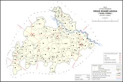 Map showing Zorawarganj (#478) in Asoha CD block | |
 Zorawarganj Location in Uttar Pradesh, India | |
| Coordinates: 26°31′57″N 80°49′22″E / 26.53250°N 80.82278°ECoordinates: 26°31′57″N 80°49′22″E / 26.53250°N 80.82278°E | |
| Country India | |
| State | Uttar Pradesh |
| District | Unnao |
| Area | |
| • Total | 5.142 km2 (1.985 sq mi) |
| Population (2011)[1] | |
| • Total | 2,553 |
| • Density | 500/km2 (1,300/sq mi) |
| Languages | |
| • Official | Hindi |
| Time zone | UTC+5:30 (IST) |
| Vehicle registration | UP-35 |
Zorawarganj is a village in Asoha block of Unnao district, Uttar Pradesh, India.[1] It is not connected to major district roads and has two primary schools and no healthcare facilities.[1] As of 2011, its population is 2,553, in 498 households.[1]
The 1961 census recorded Zorawarganj as comprising 2 hamlets, with a total population of 914 (475 male and 439 female), in 189 households and 164 physical houses.[2] The area of the village was given as 1,342 acres.[2] It had a medical practitioner at the time.[2] The village had one grain mill, two small manufacturers of textiles, and one manufacturer of items not otherwise specified.[2]
References[]
- ^ a b c d e "Census of India 2011: Uttar Pradesh District Census Handbook - Unnao, Part A (Village and Town Directory)". Census 2011 India. pp. 323–47. Retrieved 9 July 2021.
- ^ a b c d Census 1961: District Census Handbook, Uttar Pradesh (37 - Unnao District) (PDF). Lucknow. 1965. pp. xcvi-xcvii of section "Purwa Tehsil", cxxvi–cxxvii. Retrieved 9 July 2021.
This Unnao district location article is a stub. You can help Wikipedia by . |
Categories:
- Villages in Unnao district
- Lucknow division geography stubs