Sikandarpur Sarausi
Sikandarpur Sarausi is a community development block in Unnao tehsil of Unnao district, Uttar Pradesh, India.[1] It consists of 96 rural villages, with a total population of 185,779 people.[1]
Historically, there was a pargana of , which was created during the reign of Akbar in the 1500s.[2] The pargana was later renamed Sikandarpur after another one of its main villages; wrote in 1862 that the name change had "recently become habitual" then.[2]
The present block was inaugurated on 1 October 1961 in order to oversee implementation of India's Five-Year Plans at a local and rural level.[3] It was one of two blocks in the district (the other being Safipur) that was selected for implementation of the .[3] Sikandarpur, the old pargana's namesake, was chosen as the block headquarters.[3]
Demographics[]
As of 2011, Sikandarpur Sarausi CD block has a population of 185,779 people, in 36,202 households.[1] This population includes 98,687 males and 87,092 females.[1] The corresponding sex ratio of 883 females to every 1000 males is lower than the district rural average of 906.[1] About 14.4% of the block's population is in the 0-6 age group as of 2011.[1] The sex ratio of this group is 931, which is higher than the rural average of 923 for Unnao district.[1] Members of Scheduled Castes make up 26.5% of the block's population, the lowest proportion among the district's 16 CD blocks, and members of Scheduled Tribes make up 0.02%.[1] The literacy rate of Sikandarpur Sarausi block is 61.9% (counting only people age 7 and up); literacy is higher among men and boys (70.0%) than among women and girls (52.6%).[1] Among Scheduled Castes, the literacy rate is 55.2% — 63.6% among men and boys, and 45.7% among women and girls.[1] The 17.8% gender literacy gap among this group is the lowest among the blocks in Unnao district.[1]
In terms of employment, 24.9% of Sikandarpur Sarausi block residents were classified as main workers (i.e. people employed for at least 6 months per year) in 2011.[1] Marginal workers (i.e. people employed for less than 6 months per year) made up 11.2%, and the remaining 63.9% were non-workers.[1] Employment status varied significantly according to gender, with 52.9% of men being either main or marginal workers, compared to only 17.0% of women.[1]
Agriculture is the predominant source of employment in Sikandarpur Sarausi block: 36.6% of the block's workers were cultivators who owned or leased their own land as of 2011, and a further 32.1% were agricultural labourers who worked someone else's land for wages.[1] Another 3.8% were counted as household industry workers, and the remaining 27.5% were other workers.[1]
Villages[]
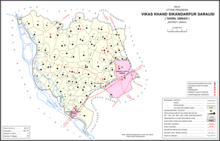
Sikandarpur Sarausi CD block has the following 96 villages:[1]
| Village name | Total land area (hectares) | Population (in 2011) |
|---|---|---|
| 13.6 | 0 | |
| 382.8 | 0 | |
| 568.2 | 2,810 | |
| 451.7 | 3,423 | |
| 273.8 | 882 | |
| Pariyar | 2,105 | 7,363 |
| 598.6 | 1,140 | |
| 930.8 | 1,033 | |
| 213.8 | 1,859 | |
| 212.5 | 929 | |
| 94.9 | 0 | |
| 106.8 | 498 | |
| 285 | 1,027 | |
| 158.9 | 571 | |
| 85.9 | 1,212 | |
| 38.3 | 378 | |
| 54 | 971 | |
| 133.8 | 1,260 | |
| 115 | 913 | |
| 827 | 5,941 | |
| 447.7 | 1,503 | |
| 191.1 | 1,688 | |
| 389.8 | 1,836 | |
| 656.2 | 3,783 | |
| 298.1 | 958 | |
| 384 | 1,304 | |
| 768.3 | 3,784 | |
| 30.2 | 491 | |
| 252.4 | 2,615 | |
| 90.5 | 812 | |
| 424.2 | 3,123 | |
| 460.3 | 3,071 | |
| Raukarna | 1,077.2 | 8,705 |
| 141 | 259 | |
| 318 | 3,890 | |
| 768.6 | 4,692 | |
| 205.5 | 992 | |
| 270 | 2,382 | |
| 901.4 | 7,423 | |
| 258.9 | 2,189 | |
| 564.3 | 4,920 | |
| 145.9 | 676 | |
| 972.3 | 8,330 | |
| 274.9 | 2,777 | |
| 325.7 | 3,236 | |
| 248.3 | 1,802 | |
| Sikander Pur | 557.9 | 4,510 |
| 167.6 | 942 | |
| 62.5 | 337 | |
| 255.7 | 1,420 | |
| Chilaula | 419.8 | 2,899 |
| 592.8 | 1,022 | |
| 211.5 | 971 | |
| 184.1 | 1,492 | |
| 185.4 | 860 | |
| 21.6 | 361 | |
| 258.1 | 758 | |
| 578.6 | 0 | |
| 245.1 | 1,564 | |
| 450.1 | 2,162 | |
| 523.5 | 2,095 | |
| 246.4 | 3,389 | |
| 335.4 | 0 | |
| 136.4 | 848 | |
| 320.2 | 0 | |
| 344.5 | 1,965 | |
| 507.2 | 4,195 | |
| 210.3 | 1,594 | |
| 126.8 | 313 | |
| 117.9 | 0 | |
| 174.7 | 437 | |
| 143.4 | 0 | |
| 62.7 | 0 | |
| 137 | 1,167 | |
| 119.2 | 656 | |
| 104.1 | 343 | |
| 293 | 0 | |
| 32.6 | 6,300 | |
| 71.4 | 628 | |
| 166.2 | 2,190 | |
| 287 | 1,842 | |
| 218.2 | 2,619 | |
| 652.8 | 6,317 | |
| 169.2 | 1,030 | |
| 182.5 | 1,385 | |
| 826.7 | 7,619 | |
| 172.6 | 3,422 | |
| 282.3 | 2,445 | |
| 78.8 | 1,531 | |
| 86.7 | 536 | |
| 201.6 | 1,253 | |
| 282.1 | 378 | |
| 422 | 533 |
References[]
- ^ a b c d e f g h i j k l m n o p q "Census of India 2011: Uttar Pradesh District Census Handbook - Unnao, Part A (Village and Town Directory)". Census 2011 India. pp. 35–54, 262–79. Retrieved 5 July 2021.
- ^ a b Nevill, H.R. (1903). Unao: A Gazetteer, Being Volume XXXVIII Of The District Gazetteers Of The United Provinces Of Agra And Oudh. Allahabad: Government Press. p. 239-43. Retrieved 5 July 2021.
- ^ a b c Baghel, Amar Singh (1979). Uttar Pradesh District Gazetteers: Unnao. Rampur: Government Press. pp. 150–2, 272–3. Retrieved 5 July 2021.
- Unnao district
- Community development blocks in India