Maharani Khera
Maharani Khera
Mahārāni Khera | |
|---|---|
Village | |
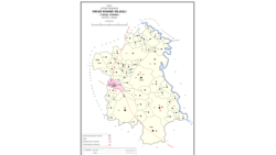 Map showing Maharani Khera (#635) in Hilauli CD block | |
 Maharani Khera Location in Uttar Pradesh, India | |
| Coordinates: 26°26′44″N 80°54′51″E / 26.445599°N 80.91417°ECoordinates: 26°26′44″N 80°54′51″E / 26.445599°N 80.91417°E[1] | |
| Country India | |
| State | Uttar Pradesh |
| District | Unnao |
| Area | |
| • Total | 4.602 km2 (1.777 sq mi) |
| Population (2011)[2] | |
| • Total | 2,683 |
| • Density | 580/km2 (1,500/sq mi) |
| Languages | |
| • Official | Hindi |
| Time zone | UTC+5:30 (IST) |
| Vehicle registration | UP-35 |

Maharani Khera is a village in Hilauli block of Unnao district, Uttar Pradesh, India.[2] As of 2011, its population is 2,683, in 502 households, and it has one primary school and no healthcare facilities.[2]
The 1961 census recorded Maharani Khera (here spelled "Mahrani Khera") as comprising 6 hamlets, with a total population of 942 (511 male and 431 female), in 210 households and 180 physical houses.[3] The area of the village was given as 1,218 acres.[3]
References[]
- ^ Search for "Maharani Khera" here https://geonames.nga.mil/namesgaz/. Missing or empty
|title=(help) - ^ a b c d "Census of India 2011: Uttar Pradesh District Census Handbook - Unnao, Part A (Village and Town Directory)". Census 2011 India. pp. 373–89. Retrieved 11 July 2021.
- ^ a b Census 1961: District Census Handbook, Uttar Pradesh (37 - Unnao District) (PDF). Lucknow. 1965. pp. cxiv-cxv of section "Purwa Tehsil". Retrieved 11 July 2021.
This Unnao district location article is a stub. You can help Wikipedia by . |
Categories:
- Villages in Unnao district
- Lucknow division geography stubs