Bareilles
Bareilles | |
|---|---|
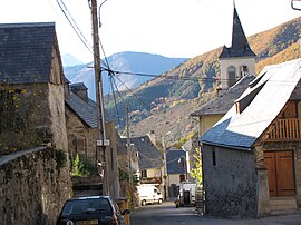 The village of Bareilles | |
 Coat of arms | |
show Location of Bareilles | |
 Bareilles | |
| Coordinates: 42°53′51″N 0°25′29″E / 42.8975°N 0.4247°ECoordinates: 42°53′51″N 0°25′29″E / 42.8975°N 0.4247°E | |
| Country | France |
| Region | Occitanie |
| Department | Hautes-Pyrénées |
| Arrondissement | Bagnères-de-Bigorre |
| Canton | Neste, Aure et Louron |
| Government | |
| • Mayor (2020–2026) | Jocelyne Vidaillet |
| Area 1 | 20.84 km2 (8.05 sq mi) |
| Population (Jan. 2018)[1] | 48 |
| • Density | 2.3/km2 (6.0/sq mi) |
| Time zone | UTC+01:00 (CET) |
| • Summer (DST) | UTC+02:00 (CEST) |
| INSEE/Postal code | 65064 /65240 |
| Elevation | 823–2,150 m (2,700–7,054 ft) (avg. 1,000 m or 3,300 ft) |
| 1 French Land Register data, which excludes lakes, ponds, glaciers > 1 km2 (0.386 sq mi or 247 acres) and river estuaries. | |


Bareilles (French pronunciation: [baʁɛj]; Occitan: Era Varelha) is a commune in the Hautes-Pyrénées department in southwestern France.
Population[]
| Year | Pop. | ±% |
|---|---|---|
| 1962 | 96 | — |
| 1968 | 102 | +6.2% |
| 1975 | 80 | −21.6% |
| 1982 | 69 | −13.7% |
| 1990 | 57 | −17.4% |
| 1999 | 67 | +17.5% |
| 2007 | 65 | −3.0% |
| 2009 | 61 | −6.2% |
See also[]
References[]
- ^ "Populations légales 2018". INSEE. 28 December 2020.
| Wikimedia Commons has media related to Bareilles. |
| show Authority control |
|---|
This Hautes-Pyrénées geographical article is a stub. You can help Wikipedia by . |
Categories:
- Communes of Hautes-Pyrénées
- Hautes-Pyrénées geography stubs