Betpouey
Betpouey | |
|---|---|
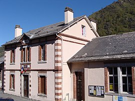 The town hall | |
 Coat of arms | |
show Location of Betpouey | |
 Betpouey | |
| Coordinates: 42°52′57″N 0°02′02″E / 42.8825°N 0.0339°ECoordinates: 42°52′57″N 0°02′02″E / 42.8825°N 0.0339°E | |
| Country | France |
| Region | Occitanie |
| Department | Hautes-Pyrénées |
| Arrondissement | Argelès-Gazost |
| Canton | La Vallée des Gaves |
| Government | |
| • Mayor (2020–2026) | Bernard Souberbielle[1] |
| Area 1 | 16.2 km2 (6.3 sq mi) |
| Population (Jan. 2018)[2] | 86 |
| • Density | 5.3/km2 (14/sq mi) |
| Time zone | UTC+01:00 (CET) |
| • Summer (DST) | UTC+02:00 (CEST) |
| INSEE/Postal code | 65089 /65120 |
| Elevation | 899–2,854 m (2,949–9,364 ft) (avg. 1,250 m or 4,100 ft) |
| 1 French Land Register data, which excludes lakes, ponds, glaciers > 1 km2 (0.386 sq mi or 247 acres) and river estuaries. | |


Betpouey is a commune in the Hautes-Pyrénées department in southwestern France.
Geography[]
The Petite Baïse forms part of the commune's southwestern border, then flows north through the middle of the commune.
Population[]
| Year | Pop. | ±% |
|---|---|---|
| 1962 | 204 | — |
| 1968 | 226 | +10.8% |
| 1975 | 175 | −22.6% |
| 1982 | 160 | −8.6% |
| 1990 | 149 | −6.9% |
| 1999 | 128 | −14.1% |
| 2007 | 111 | −13.3% |
| 2009 | 109 | −1.8% |
See also[]
References[]
- ^ "Répertoire national des élus: les maires". data.gouv.fr, Plateforme ouverte des données publiques françaises (in French). 2 December 2020.
- ^ "Populations légales 2018". INSEE. 28 December 2020.
| Wikimedia Commons has media related to Betpouey. |
This Hautes-Pyrénées geographical article is a stub. You can help Wikipedia by . |
Categories:
- Communes of Hautes-Pyrénées
- Hautes-Pyrénées geography stubs