Bonnefont
Bonnefont | |
|---|---|
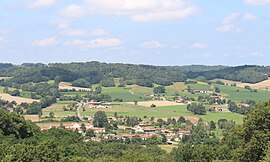 View of Bonnefont | |
 Coat of arms | |
show Location of Bonnefont | |
 Bonnefont | |
| Coordinates: 43°15′04″N 0°20′49″E / 43.2511°N 0.3469°ECoordinates: 43°15′04″N 0°20′49″E / 43.2511°N 0.3469°E | |
| Country | France |
| Region | Occitanie |
| Department | Hautes-Pyrénées |
| Arrondissement | Tarbes |
| Canton | Les Coteaux |
| Government | |
| • Mayor (2020–2026) | Anne-Marie Bruzeaud |
| Area 1 | 15.37 km2 (5.93 sq mi) |
| Population (Jan. 2018)[1] | 331 |
| • Density | 22/km2 (56/sq mi) |
| Time zone | UTC+01:00 (CET) |
| • Summer (DST) | UTC+02:00 (CEST) |
| INSEE/Postal code | 65095 /65220 |
| Elevation | 275–476 m (902–1,562 ft) (avg. 380 m or 1,250 ft) |
| 1 French Land Register data, which excludes lakes, ponds, glaciers > 1 km2 (0.386 sq mi or 247 acres) and river estuaries. | |


Bonnefont (French pronunciation: [bɔnfɔ̃]; Occitan: Bonahont) is a commune in the Hautes-Pyrénées department in southwestern France.
Population[]
| Year | Pop. | ±% |
|---|---|---|
| 1962 | 421 | — |
| 1968 | 463 | +10.0% |
| 1975 | 422 | −8.9% |
| 1982 | 313 | −25.8% |
| 1990 | 358 | +14.4% |
| 1999 | 313 | −12.6% |
| 2007 | 354 | +13.1% |
| 2009 | 353 | −0.3% |
See also[]
References[]
- ^ "Populations légales 2018". INSEE. 28 December 2020.
| Wikimedia Commons has media related to Bonnefont. |
| show Authority control |
|---|
This Hautes-Pyrénées geographical article is a stub. You can help Wikipedia by . |
Categories:
- Communes of Hautes-Pyrénées
- Hautes-Pyrénées geography stubs