Bozel
Bozel | |
|---|---|
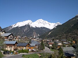 The church and surrounding buildings in Bozel | |
show Location of Bozel | |
 Bozel | |
| Coordinates: 45°27′08″N 6°38′56″E / 45.4522°N 6.6488°ECoordinates: 45°27′08″N 6°38′56″E / 45.4522°N 6.6488°E | |
| Country | France |
| Region | Auvergne-Rhône-Alpes |
| Department | Savoie |
| Arrondissement | Albertville |
| Canton | Moûtiers |
| Intercommunality | Val Vanoise |
| Government | |
| • Mayor (2020–2026) | Sylvain Pulcini |
| Area 1 | 28.8 km2 (11.1 sq mi) |
| Population (Jan. 2018)[1] | 1,864 |
| • Density | 65/km2 (170/sq mi) |
| Time zone | UTC+01:00 (CET) |
| • Summer (DST) | UTC+02:00 (CEST) |
| INSEE/Postal code | 73055 /73350 |
| Elevation | 746–2,589 m (2,448–8,494 ft) (avg. 768 m or 2,520 ft) |
| Website | www.ot-bozel.com, www.bozelinfo.com |
| 1 French Land Register data, which excludes lakes, ponds, glaciers > 1 km2 (0.386 sq mi or 247 acres) and river estuaries. | |


Bozel (French pronunciation: [bɔzɛl]) is a commune in the Savoie department in the Auvergne-Rhône-Alpes region in south-eastern France.
Bozel has one surface ski lift and a green run. It has 19 km of cross-country trails.
See also[]
References[]
- ^ "Populations légales 2018". INSEE. 28 December 2020.
External links[]
| Wikimedia Commons has media related to Bozel. |
 Bozel travel guide from Wikivoyage
- Official site
| show Authority control |
|---|
This Savoie geographical article is a stub. You can help Wikipedia by . |
Categories:
- Communes of Savoie
- Savoie geography stubs