Campuzan
Campuzan | |
|---|---|
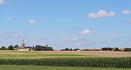 View of Campuzan | |
 Coat of arms | |
show Location of Campuzan | |
 Campuzan | |
| Coordinates: 43°16′20″N 0°25′45″E / 43.2722°N 0.4292°ECoordinates: 43°16′20″N 0°25′45″E / 43.2722°N 0.4292°E | |
| Country | France |
| Region | Occitanie |
| Department | Hautes-Pyrénées |
| Arrondissement | Tarbes |
| Canton | Les Coteaux |
| Intercommunality | Pays de Trie et Magnoac |
| Government | |
| • Mayor (2020–2026) | Guy Fontan |
| Area 1 | 6.62 km2 (2.56 sq mi) |
| Population (Jan. 2018)[1] | 151 |
| • Density | 23/km2 (59/sq mi) |
| Time zone | UTC+01:00 (CET) |
| • Summer (DST) | UTC+02:00 (CEST) |
| INSEE/Postal code | 65126 /65230 |
| Elevation | 249–333 m (817–1,093 ft) (avg. 300 m or 980 ft) |
| 1 French Land Register data, which excludes lakes, ponds, glaciers > 1 km2 (0.386 sq mi or 247 acres) and river estuaries. | |


Campuzan (French pronunciation: [kɑ̃pyzɑ̃]; Occitan: Campudan) is a commune in the Hautes-Pyrénées department in south-western France.
The area is known for its mountainous agricultural landscape of villages, farms, fields, upland pastures and winding mountain roads.
Before the French Revolution, this town was one of many within the former province of Gascony before the region was renamed and re-bordered as the Occitanie region of France.
See also[]
References[]
- ^ "Populations légales 2018". INSEE. 28 December 2020.
External links[]
| Wikimedia Commons has media related to Campuzan. |
- Campuzan on the Lion site[permanent dead link]
This Hautes-Pyrénées geographical article is a stub. You can help Wikipedia by . |
Categories:
- Communes of Hautes-Pyrénées
- Hautes-Pyrénées geography stubs