Casterets
Casterets | |
|---|---|
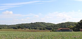 View of Casterets | |
 Coat of arms | |
show Location of Casterets | |
 Casterets | |
| Coordinates: 43°18′50″N 0°35′25″E / 43.3139°N 0.5903°ECoordinates: 43°18′50″N 0°35′25″E / 43.3139°N 0.5903°E | |
| Country | France |
| Region | Occitanie |
| Department | Hautes-Pyrénées |
| Arrondissement | Tarbes |
| Canton | Les Coteaux |
| Intercommunality | |
| Government | |
| • Mayor (2020–2026) | Didier Boyer[1] |
| Area 1 | 1.86 km2 (0.72 sq mi) |
| Population (Jan. 2018)[2] | 13 |
| • Density | 7.0/km2 (18/sq mi) |
| Time zone | UTC+01:00 (CET) |
| • Summer (DST) | UTC+02:00 (CEST) |
| INSEE/Postal code | 65134 /65230 |
| Elevation | 290–376 m (951–1,234 ft) (avg. 350 m or 1,150 ft) |
| 1 French Land Register data, which excludes lakes, ponds, glaciers > 1 km2 (0.386 sq mi or 247 acres) and river estuaries. | |


Casterets is a commune in the Hautes-Pyrénées department in south-western France.
Population[]
| Year | Pop. | ±% |
|---|---|---|
| 2006 | 15 | — |
| 2007 | 15 | +0.0% |
| 2008 | 16 | +6.7% |
| 2009 | 14 | −12.5% |
| 2010 | 13 | −7.1% |
| 2011 | 13 | +0.0% |
| 2012 | 13 | +0.0% |
| 2013 | 13 | +0.0% |
| 2014 | 13 | +0.0% |
| 2015 | 13 | +0.0% |
| 2016 | 13 | +0.0% |
Politics[]
Presidential Elections Second Round:[3]
| Election | Winning Candidate | Party | % | |
|---|---|---|---|---|
| 2017 | Emmanuel Macron | EM | 85.71 | |
| 2012 | Nicolas Sarkozy | UMP | 55.56 | |
| 2007 | Nicolas Sarkozy | UMP | 66.67 | |
| 2002 | Jacques Chirac | RPR | 100.00 | |
See also[]
References[]
- ^ "Répertoire national des élus: les maires". data.gouv.fr, Plateforme ouverte des données publiques françaises (in French). 2 December 2020.
- ^ "Populations légales 2018". INSEE. 28 December 2020.
- ^ http://www.lemonde.fr/data/france/presidentielle-2017/
| Wikimedia Commons has media related to Casterets. |
This Hautes-Pyrénées geographical article is a stub. You can help Wikipedia by . |
Categories:
- Communes of Hautes-Pyrénées
- Hautes-Pyrénées geography stubs