Castillon-du-Gard
Castillon-du-Gard | |
|---|---|
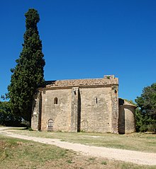
 A general view of Castillon-du-Gard | |
 Coat of arms | |
show Location of Castillon-du-Gard | |
 Castillon-du-Gard | |
| Coordinates: 43°58′15″N 4°33′19″E / 43.9708°N 4.5553°ECoordinates: 43°58′15″N 4°33′19″E / 43.9708°N 4.5553°E | |
| Country | France |
| Region | Occitanie |
| Department | Gard |
| Arrondissement | Nîmes |
| Canton | Redessan |
| Intercommunality | Pont du Gard |
| Government | |
| • Mayor (2008–2014) | Jean Louis Berne |
| Area 1 | 17.38 km2 (6.71 sq mi) |
| Population (Jan. 2018)[1] | 1,665 |
| • Density | 96/km2 (250/sq mi) |
| Time zone | UTC+01:00 (CET) |
| • Summer (DST) | UTC+02:00 (CEST) |
| INSEE/Postal code | 30073 /30210 |
| Elevation | 17–194 m (56–636 ft) (avg. 98 m or 322 ft) |
| 1 French Land Register data, which excludes lakes, ponds, glaciers > 1 km2 (0.386 sq mi or 247 acres) and river estuaries. | |


Castillon-du-Gard is a commune in the Gard department in southern France.
Population[]
| Year | Pop. | ±% |
|---|---|---|
| 1962 | 434 | — |
| 1968 | 468 | +7.8% |
| 1975 | 589 | +25.9% |
| 1982 | 716 | +21.6% |
| 1990 | 759 | +6.0% |
| 1999 | 943 | +24.2% |
| 2008 | 1,306 | +38.5% |
| 2016 | 1,802 | +38.0% |
See also[]
- Communes of the Gard department
References[]
| Wikimedia Commons has media related to Castillon-du-Gard. |
- ^ "Populations légales 2018". INSEE. 28 December 2020.
| show Communes of the Gard department |
|---|
| show Authority control |
|---|
This Gard geographical article is a stub. You can help Wikipedia by . |
Categories:
- Communes of Gard
- Gard geography stubs