Cavillargues
Cavillargues | |
|---|---|
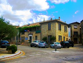 The town hall of Cavillargues | |
 Coat of arms | |
show Location of Cavillargues | |
 Cavillargues | |
| Coordinates: 44°06′54″N 4°31′22″E / 44.115°N 4.5227°ECoordinates: 44°06′54″N 4°31′22″E / 44.115°N 4.5227°E | |
| Country | France |
| Region | Occitanie |
| Department | Gard |
| Arrondissement | Nîmes |
| Canton | Bagnols-sur-Cèze |
| Intercommunality | Gard rhodanien |
| Government | |
| • Mayor (2020–2026) | Laurent Nadal[1] |
| Area 1 | 11.27 km2 (4.35 sq mi) |
| Population (Jan. 2018)[2] | 858 |
| • Density | 76/km2 (200/sq mi) |
| Time zone | UTC+01:00 (CET) |
| • Summer (DST) | UTC+02:00 (CEST) |
| INSEE/Postal code | 30076 /30330 |
| Elevation | 105–262 m (344–860 ft) (avg. 137 m or 449 ft) |
| 1 French Land Register data, which excludes lakes, ponds, glaciers > 1 km2 (0.386 sq mi or 247 acres) and river estuaries. | |


Cavillargues (French pronunciation: [kavijaʁɡ]; Occitan: Cavilhargas) is a commune in the Gard department in southern France.
Population[]
| Year | Pop. | ±% |
|---|---|---|
| 1962 | 495 | — |
| 1968 | 510 | +3.0% |
| 1975 | 445 | −12.7% |
| 1982 | 492 | +10.6% |
| 1990 | 601 | +22.2% |
| 1999 | 645 | +7.3% |
| 2008 | 772 | +19.7% |
| 2011 | 806 | +4.4% |
See also[]
- Communes of the Gard department
References[]
- ^ "Répertoire national des élus: les maires". data.gouv.fr, Plateforme ouverte des données publiques françaises (in French). 2 December 2020.
- ^ "Populations légales 2018". INSEE. 28 December 2020.
External links[]
| Wikimedia Commons has media related to Cavillargues. |
| show Communes of the Gard department |
|---|
| show Authority control |
|---|
This Gard geographical article is a stub. You can help Wikipedia by . |
Categories:
- Communes of Gard
- Gard geography stubs