Chabrillan
Chabrillan | |
|---|---|
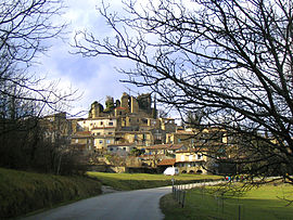 A general view of Chabrillan | |
show Location of Chabrillan | |
 Chabrillan | |
| Coordinates: 44°43′28″N 4°56′32″E / 44.7244°N 4.9422°ECoordinates: 44°43′28″N 4°56′32″E / 44.7244°N 4.9422°E | |
| Country | France |
| Region | Auvergne-Rhône-Alpes |
| Department | Drôme |
| Arrondissement | Die |
| Canton | Crest |
| Intercommunality | Val de Drôme en Biovallée |
| Government | |
| • Mayor (2020–2026) | Cyrille Vallon |
| Area 1 | 17.75 km2 (6.85 sq mi) |
| Population (Jan. 2018)[1] | 736 |
| • Density | 41/km2 (110/sq mi) |
| Time zone | UTC+01:00 (CET) |
| • Summer (DST) | UTC+02:00 (CEST) |
| INSEE/Postal code | 26065 /26400 |
| Elevation | 149–352 m (489–1,155 ft) |
| 1 French Land Register data, which excludes lakes, ponds, glaciers > 1 km2 (0.386 sq mi or 247 acres) and river estuaries. | |


Chabrillan (French pronunciation: [ʃabʁijɑ̃]; Occitan: Chabrelha) is a commune of the Drôme département in southeastern France.
Population[]
| Year | Pop. | ±% |
|---|---|---|
| 1911 | 707 | — |
| 1962 | 519 | −26.6% |
| 1968 | 474 | −8.7% |
| 1975 | 494 | +4.2% |
| 1982 | 544 | +10.1% |
| 1990 | 629 | +15.6% |
| 1999 | 608 | −3.3% |
| 2008 | 659 | +8.4% |
Sights and monuments[]
The French Ministry of Culture has designated two buildings as monuments historiques in Chabrillan:
- Château de Chabrillan, ruins of medieval castle.[2]
- Eglise Saint-Pierre, the church.[3]
See also[]
References[]
- ^ "Populations légales 2018". INSEE. 28 December 2020.
- ^ Base Mérimée: Chabrillan: Château (restes), Ministère français de la Culture. (in French)
- ^ Base Mérimée: Chabrillan: Eglise Saint-Pierre, Ministère français de la Culture. (in French)
External links[]
| Wikimedia Commons has media related to Chabrillan. |
- Base Mérimée: Château de Chabrillan, Ministère français de la Culture. (in French)
- Base Mérimée: Eglise Saint-Pierre, Ministère français de la Culture. (in French)
| show Authority control |
|---|
This Drôme geographical article is a stub. You can help Wikipedia by . |
Categories:
- Communes of Drôme
- Drôme geography stubs