Channay
From Wikipedia, the free encyclopedia
For the South Asian dish, see Chana masala.
show This article may be expanded with text translated from the corresponding article in French. (January 2009) Click [show] for important translation instructions.
|
Commune in Bourgogne-Franche-Comté, France
Channay | |
|---|---|
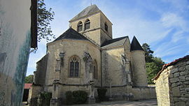 The church in Channay | |
 Channay  Channay | |
Coordinates:  47°52′59″N 4°19′57″E / 47.8831°N 4.3325°E / 47.8831; 4.3325Coordinates: 47°52′59″N 4°19′57″E / 47.8831°N 4.3325°E / 47.8831; 4.3325 47°52′59″N 4°19′57″E / 47.8831°N 4.3325°E / 47.8831; 4.3325Coordinates: 47°52′59″N 4°19′57″E / 47.8831°N 4.3325°E / 47.8831; 4.3325 | |
| Country | France |
| Region | Bourgogne-Franche-Comté |
| Department | Côte-d'Or |
| Arrondissement | Montbard |
| Canton | Châtillon-sur-Seine |
| Government | |
| • Mayor (2020–2026) | Hubert Collin[1] |
| Area 1 | 13.33 km2 (5.15 sq mi) |
| Population (Jan. 2018)[2] | 65 |
| • Density | 4.9/km2 (13/sq mi) |
| Time zone | UTC+01:00 (CET) |
| • Summer (DST) | UTC+02:00 (CEST) |
| INSEE/Postal code | 21143 /21330 |
| Elevation | 197–288 m (646–945 ft) (avg. 208 m or 682 ft) |
| 1 French Land Register data, which excludes lakes, ponds, glaciers > 1 km2 (0.386 sq mi or 247 acres) and river estuaries. | |

Channay is a commune in the Côte-d'Or department in eastern France.
Population[]
| Year | Pop. | ±% |
|---|---|---|
| 1962 | 102 | — |
| 1968 | 106 | +3.9% |
| 1975 | 74 | −30.2% |
| 1982 | 68 | −8.1% |
| 1990 | 70 | +2.9% |
| 1999 | 76 | +8.6% |
| 2008 | 65 | −14.5% |
See also[]
References[]
- ^ "Répertoire national des élus: les maires". data.gouv.fr, Plateforme ouverte des données publiques françaises (in French). 2 December 2020.
- ^ "Populations légales 2018". INSEE. 28 December 2020.
| Wikimedia Commons has media related to Channay. |
| show | |
|---|---|
|
Retrieved from ""
Categories:
- Communes of Côte-d'Or
- Côte-d'Or geography stubs
Hidden categories:
- CS1 French-language sources (fr)
- Articles to be expanded from January 2009
- All articles to be expanded
- Geography articles needing translation from French Wikipedia
- Articles with short description
- Short description is different from Wikidata
- Infobox mapframe without OSM relation ID on Wikidata
- Coordinates on Wikidata
- Pages using infobox settlement with image map1 but not image map
- Commons category link from Wikidata
- Articles with BNF identifiers
- All stub articles
- Pages using the Kartographer extension