Chantillac
Chantillac | |
|---|---|
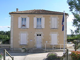 Town hall | |
show Location of Chantillac | |
 Chantillac | |
| Coordinates: 45°19′24″N 0°15′16″W / 45.3233°N 0.2544°WCoordinates: 45°19′24″N 0°15′16″W / 45.3233°N 0.2544°W | |
| Country | France |
| Region | Nouvelle-Aquitaine |
| Department | Charente |
| Arrondissement | Cognac |
| Canton | Charente-Sud |
| Intercommunality | 4B Sud-Charente |
| Government | |
| • Mayor (2020–2026) | Jean-Marie Veyssiere |
| Area 1 | 18.05 km2 (6.97 sq mi) |
| Population (Jan. 2018)[1] | 342 |
| • Density | 19/km2 (49/sq mi) |
| Time zone | UTC+01:00 (CET) |
| • Summer (DST) | UTC+02:00 (CEST) |
| INSEE/Postal code | 16079 /16360 |
| Elevation | 65–151 m (213–495 ft) (avg. 145 m or 476 ft) |
| 1 French Land Register data, which excludes lakes, ponds, glaciers > 1 km2 (0.386 sq mi or 247 acres) and river estuaries. | |


Chantillac (French pronunciation: [ʃɑ̃tijak]) is a commune in the Charente department in southwestern France.
Population[]
|
|
See also[]
References[]
- ^ "Populations légales 2018". INSEE. 28 December 2020.
| Wikimedia Commons has media related to Chantillac. |
This Charente geographical article is a stub. You can help Wikipedia by . |
Categories:
- Communes of Charente
- Charente geography stubs