Saint-Sornin, Charente
show This article may be expanded with text translated from the corresponding article in French. (December 2008) Click [show] for important translation instructions. |
Saint-Sornin | |
|---|---|
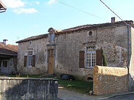 Old house | |
show Location of Saint-Sornin | |
 Saint-Sornin | |
| Coordinates: 45°41′41″N 0°26′11″E / 45.6947°N 0.4364°ECoordinates: 45°41′41″N 0°26′11″E / 45.6947°N 0.4364°E | |
| Country | France |
| Region | Nouvelle-Aquitaine |
| Department | Charente |
| Arrondissement | Angoulême |
| Canton | Val de Tardoire |
| Intercommunality | La Rochefoucauld - Porte du Périgord |
| Government | |
| • Mayor (2008–2014) | Marcel Rapion |
| Area 1 | 11.27 km2 (4.35 sq mi) |
| Population (Jan. 2018)[1] | 794 |
| • Density | 70/km2 (180/sq mi) |
| Time zone | UTC+01:00 (CET) |
| • Summer (DST) | UTC+02:00 (CEST) |
| INSEE/Postal code | 16353 /16220 |
| Elevation | 89–242 m (292–794 ft) (avg. 185 m or 607 ft) |
| 1 French Land Register data, which excludes lakes, ponds, glaciers > 1 km2 (0.386 sq mi or 247 acres) and river estuaries. | |


Saint-Sornin is a commune in the Charente department in southwestern France.
Population[]
|
|
See also[]
References[]
- ^ "Populations légales 2018". INSEE. 28 December 2020.
| Wikimedia Commons has media related to Saint-Sornin (Charente). |
This Charente geographical article is a stub. You can help Wikipedia by . |
Categories:
- Communes of Charente
- Charente geography stubs