Rouffiac, Charente
Rouffiac | |
|---|---|
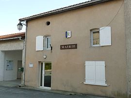 The town hall in Rouffiac | |
show Location of Rouffiac | |
 Rouffiac | |
| Coordinates: 45°16′10″N 0°04′57″E / 45.2694°N 0.0825°ECoordinates: 45°16′10″N 0°04′57″E / 45.2694°N 0.0825°E | |
| Country | France |
| Region | Nouvelle-Aquitaine |
| Department | Charente |
| Arrondissement | Angoulême |
| Canton | Tude-et-Lavalette |
| Intercommunality | Lavalette Tude Dronne |
| Government | |
| • Mayor (2020–2026) | Éric Rocher |
| Area 1 | 9.89 km2 (3.82 sq mi) |
| Population (Jan. 2018)[1] | 120 |
| • Density | 12/km2 (31/sq mi) |
| Time zone | UTC+01:00 (CET) |
| • Summer (DST) | UTC+02:00 (CEST) |
| INSEE/Postal code | 16284 /16210 |
| Elevation | 45–170 m (148–558 ft) (avg. 156 m or 512 ft) |
| 1 French Land Register data, which excludes lakes, ponds, glaciers > 1 km2 (0.386 sq mi or 247 acres) and river estuaries. | |


Rouffiac (French pronunciation: [ʁufjak]) is a commune in the Charente department in southwestern France.
Population[]
|
|
See also[]
References[]
- ^ "Populations légales 2018". INSEE. 28 December 2020.
| Wikimedia Commons has media related to Rouffiac (Charente). |
This Charente geographical article is a stub. You can help Wikipedia by . |
Categories:
- Communes of Charente
- Charente geography stubs