Mareuil, Charente
Mareuil | |
|---|---|
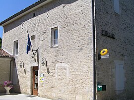 Town hall | |
show Location of Mareuil | |
 Mareuil | |
| Coordinates: 45°46′28″N 0°08′24″W / 45.7744°N 0.14°WCoordinates: 45°46′28″N 0°08′24″W / 45.7744°N 0.14°W | |
| Country | France |
| Region | Nouvelle-Aquitaine |
| Department | Charente |
| Arrondissement | Cognac |
| Canton | Val de Nouère |
| Intercommunality | Rouillacais |
| Government | |
| • Mayor (2020–2026) | Claudine Rodet[1] |
| Area 1 | 11.51 km2 (4.44 sq mi) |
| Population (Jan. 2018)[2] | 405 |
| • Density | 35/km2 (91/sq mi) |
| Time zone | UTC+01:00 (CET) |
| • Summer (DST) | UTC+02:00 (CEST) |
| INSEE/Postal code | 16208 /16170 |
| Elevation | 53–125 m (174–410 ft) (avg. 164 m or 538 ft) |
| 1 French Land Register data, which excludes lakes, ponds, glaciers > 1 km2 (0.386 sq mi or 247 acres) and river estuaries. | |


Mareuil is a commune in the Charente department in southwestern France.
Population[]
|
|
See also[]
References[]
- ^ "Répertoire national des élus: les maires". data.gouv.fr, Plateforme ouverte des données publiques françaises (in French). 2 December 2020.
- ^ "Populations légales 2018". INSEE. 28 December 2020.
| Wikimedia Commons has media related to Mareuil (Charente). |
This Charente geographical article is a stub. You can help Wikipedia by . |
Categories:
- Communes of Charente
- Charente geography stubs