Fouqueure
Fouqueure | |
|---|---|
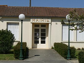 The town hall in Fouqueure | |
show Location of Fouqueure | |
 Fouqueure | |
| Coordinates: 45°53′05″N 0°04′26″E / 45.8847°N 0.0739°ECoordinates: 45°53′05″N 0°04′26″E / 45.8847°N 0.0739°E | |
| Country | France |
| Region | Nouvelle-Aquitaine |
| Department | Charente |
| Arrondissement | Confolens |
| Canton | Charente-Nord |
| Government | |
| • Mayor (2020–2026) | Yves Flaud |
| Area 1 | 16.43 km2 (6.34 sq mi) |
| Population (Jan. 2018)[1] | 414 |
| • Density | 25/km2 (65/sq mi) |
| Time zone | UTC+01:00 (CET) |
| • Summer (DST) | UTC+02:00 (CEST) |
| INSEE/Postal code | 16144 /16140 |
| Elevation | 50–123 m (164–404 ft) (avg. 70 m or 230 ft) |
| 1 French Land Register data, which excludes lakes, ponds, glaciers > 1 km2 (0.386 sq mi or 247 acres) and river estuaries. | |


Fouqueure (French pronunciation: [fukœʁ]) is a commune in the Charente department in southwestern France.
Population[]
|
|
See also[]
References[]
- ^ "Populations légales 2018". INSEE. 28 December 2020.
| Wikimedia Commons has media related to Fouqueure. |
This Charente geographical article is a stub. You can help Wikipedia by . |
Categories:
- Communes of Charente
- Charente geography stubs