Pérignac, Charente
Pérignac | |
|---|---|
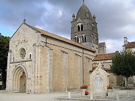 The church in Pérignac | |
show Location of Pérignac | |
 Pérignac | |
| Coordinates: 45°27′55″N 0°04′42″E / 45.4653°N 0.0783°ECoordinates: 45°27′55″N 0°04′42″E / 45.4653°N 0.0783°E | |
| Country | France |
| Region | Nouvelle-Aquitaine |
| Department | Charente |
| Arrondissement | Cognac |
| Canton | Charente-Sud |
| Government | |
| • Mayor (2008–2014) | Christian Matrat |
| Area 1 | 25.52 km2 (9.85 sq mi) |
| Population (Jan. 2018)[1] | 473 |
| • Density | 19/km2 (48/sq mi) |
| Time zone | UTC+01:00 (CET) |
| • Summer (DST) | UTC+02:00 (CEST) |
| INSEE/Postal code | 16258 /16250 |
| Elevation | 77–189 m (253–620 ft) (avg. 182 m or 597 ft) |
| 1 French Land Register data, which excludes lakes, ponds, glaciers > 1 km2 (0.386 sq mi or 247 acres) and river estuaries. | |


Pérignac is a commune in the Charente department in southwestern France.
Population[]
|
|
The residents are called Pérignacais.
See also[]
References[]
- ^ "Populations légales 2018". INSEE. 28 December 2020.
External links[]
| Wikimedia Commons has media related to Pérignac (Charente). |
This Charente geographical article is a stub. You can help Wikipedia by . |
Categories:
- Communes of Charente
- Charente geography stubs