Saint-Félix, Charente
show This article may be expanded with text translated from the corresponding article in French. (December 2008) Click [show] for important translation instructions. |
Saint-Félix | |
|---|---|
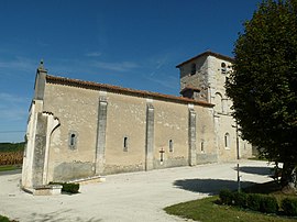 The church in Saint-Félix | |
show Location of Saint-Félix | |
 Saint-Félix | |
| Coordinates: 45°22′33″N 0°00′41″E / 45.3758°N 0.0114°ECoordinates: 45°22′33″N 0°00′41″E / 45.3758°N 0.0114°E | |
| Country | France |
| Region | Nouvelle-Aquitaine |
| Department | Charente |
| Arrondissement | Cognac |
| Canton | Charente-Sud |
| Intercommunality | 4B Sud-Charente |
| Government | |
| • Mayor (2020–2026) | Marie-Claire Aubrit[1] |
| Area 1 | 8.08 km2 (3.12 sq mi) |
| Population (Jan. 2018)[2] | 109 |
| • Density | 13/km2 (35/sq mi) |
| Time zone | UTC+01:00 (CET) |
| • Summer (DST) | UTC+02:00 (CEST) |
| INSEE/Postal code | 16315 /16480 |
| Elevation | 84–175 m (276–574 ft) (avg. 150 m or 490 ft) |
| 1 French Land Register data, which excludes lakes, ponds, glaciers > 1 km2 (0.386 sq mi or 247 acres) and river estuaries. | |


Saint-Félix is a commune in the Charente department in southwestern France.
Population[]
|
|
See also[]
References[]
- ^ "Répertoire national des élus: les maires". data.gouv.fr, Plateforme ouverte des données publiques françaises (in French). 2 December 2020.
- ^ "Populations légales 2018". INSEE. 28 December 2020.
| Wikimedia Commons has media related to Saint-Félix (Charente). |
This Charente geographical article is a stub. You can help Wikipedia by . |
Categories:
- Communes of Charente
- Charente geography stubs