Juillé, Charente
Juillé | |
|---|---|
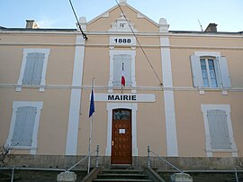 Town hall | |
show Location of Juillé | |
 Juillé | |
| Coordinates: 45°55′52″N 0°08′40″E / 45.9311°N 0.1444°ECoordinates: 45°55′52″N 0°08′40″E / 45.9311°N 0.1444°E | |
| Country | France |
| Region | Nouvelle-Aquitaine |
| Department | Charente |
| Arrondissement | Confolens |
| Canton | Boixe-et-Manslois |
| Government | |
| • Mayor (2020–2026) | Pascal Kaud[1] |
| Area 1 | 8.60 km2 (3.32 sq mi) |
| Population (Jan. 2018)[2] | 184 |
| • Density | 21/km2 (55/sq mi) |
| Time zone | UTC+01:00 (CET) |
| • Summer (DST) | UTC+02:00 (CEST) |
| INSEE/Postal code | 16173 /16230 |
| Elevation | 56–116 m (184–381 ft) (avg. 116 m or 381 ft) |
| 1 French Land Register data, which excludes lakes, ponds, glaciers > 1 km2 (0.386 sq mi or 247 acres) and river estuaries. | |


Juillé is a commune in the Charente department in southwestern France.
Population[]
|
|
See also[]
References[]
- ^ "Répertoire national des élus: les maires". data.gouv.fr, Plateforme ouverte des données publiques françaises (in French). 2 December 2020.
- ^ "Populations légales 2018". INSEE. 28 December 2020.
| Wikimedia Commons has media related to Juillé (Charente). |
This Charente geographical article is a stub. You can help Wikipedia by . |
Categories:
- Communes of Charente
- Charente geography stubs