Charrecey
From Wikipedia, the free encyclopedia
Commune in Bourgogne-Franche-Comté, France
Charrecey | |
|---|---|
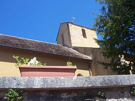 The church in Charrecey | |
 Coat of arms | |
 Charrecey  Charrecey | |
Coordinates:  46°50′23″N 4°40′03″E / 46.8397°N 4.6675°E / 46.8397; 4.6675Coordinates: 46°50′23″N 4°40′03″E / 46.8397°N 4.6675°E / 46.8397; 4.6675 46°50′23″N 4°40′03″E / 46.8397°N 4.6675°E / 46.8397; 4.6675Coordinates: 46°50′23″N 4°40′03″E / 46.8397°N 4.6675°E / 46.8397; 4.6675 | |
| Country | France |
| Region | Bourgogne-Franche-Comté |
| Department | Saône-et-Loire |
| Arrondissement | Chalon-sur-Saône |
| Canton | Chagny |
| Intercommunality | CA Le Grand Chalon |
| Area 1 | 5.48 km2 (2.12 sq mi) |
| Population (Jan. 2018)[1] | 327 |
| • Density | 60/km2 (150/sq mi) |
| Time zone | UTC+01:00 (CET) |
| • Summer (DST) | UTC+02:00 (CEST) |
| INSEE/Postal code | 71107 /71510 |
| Elevation | 290–455 m (951–1,493 ft) (avg. 385 m or 1,263 ft) |
| 1 French Land Register data, which excludes lakes, ponds, glaciers > 1 km2 (0.386 sq mi or 247 acres) and river estuaries. | |

Charrecey is a commune in the Saône-et-Loire department in the region of Bourgogne-Franche-Comté in eastern France.
See also[]
References[]
- ^ "Populations légales 2018". INSEE. 28 December 2020.
| Wikimedia Commons has media related to Charrecey. |
Retrieved from ""
Categories:
- Communes of Saône-et-Loire
- Saône-et-Loire geography stubs
Hidden categories:
- Articles with short description
- Short description is different from Wikidata
- Coordinates on Wikidata
- Pages using infobox settlement with image map1 but not image map
- Commons category link from Wikidata
- Articles with BNF identifiers
- All stub articles
- Pages using the Kartographer extension