Sarry, Saône-et-Loire
Sarry | |
|---|---|
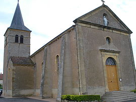 The church in Sarry | |
show Location of Sarry | |
 Sarry | |
| Coordinates: 46°18′41″N 4°07′00″E / 46.3114°N 4.1167°ECoordinates: 46°18′41″N 4°07′00″E / 46.3114°N 4.1167°E | |
| Country | France |
| Region | Bourgogne-Franche-Comté |
| Department | Saône-et-Loire |
| Arrondissement | Charolles |
| Canton | Chauffailles |
| Area 1 | 9.67 km2 (3.73 sq mi) |
| Population (Jan. 2018)[1] | 95 |
| • Density | 9.8/km2 (25/sq mi) |
| Time zone | UTC+01:00 (CET) |
| • Summer (DST) | UTC+02:00 (CEST) |
| INSEE/Postal code | 71500 /71110 |
| Elevation | 254–420 m (833–1,378 ft) (avg. 300 m or 980 ft) |
| 1 French Land Register data, which excludes lakes, ponds, glaciers > 1 km2 (0.386 sq mi or 247 acres) and river estuaries. | |


Sarry is a commune in the Saône-et-Loire department in the region of Bourgogne-Franche-Comté in eastern France.
Geography[]
The Arconce forms part of the commune's northwestern border. The village lies on the left bank of the Belaine, a tributary of the Arconce.
See also[]
References[]
- ^ "Populations légales 2018". INSEE. 28 December 2020.
| Wikimedia Commons has media related to Sarry (Saône-et-Loire). |
This Saône-et-Loire geographical article is a stub. You can help Wikipedia by . |
Categories:
- Communes of Saône-et-Loire
- Saône-et-Loire geography stubs