Montagny-lès-Buxy
Montagny-lès-Buxy | |
|---|---|
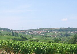 A general view of Montagny-lès-Buxy | |
show Location of Montagny-lès-Buxy | |
 Montagny-lès-Buxy | |
| Coordinates: 46°42′25″N 4°40′15″E / 46.7069°N 4.6708°ECoordinates: 46°42′25″N 4°40′15″E / 46.7069°N 4.6708°E | |
| Country | France |
| Region | Bourgogne-Franche-Comté |
| Department | Saône-et-Loire |
| Arrondissement | Chalon-sur-Saône |
| Canton | Givry |
| Intercommunality | Sud Côte Chalonnaise |
| Government | |
| • Mayor (2020–2026) | Pierre Robin[1] |
| Area 1 | 5.27 km2 (2.03 sq mi) |
| Population (Jan. 2018)[2] | 216 |
| • Density | 41/km2 (110/sq mi) |
| Time zone | UTC+01:00 (CET) |
| • Summer (DST) | UTC+02:00 (CEST) |
| INSEE/Postal code | 71302 /71390 |
| Elevation | 245–415 m (804–1,362 ft) (avg. 380 m or 1,250 ft) |
| 1 French Land Register data, which excludes lakes, ponds, glaciers > 1 km2 (0.386 sq mi or 247 acres) and river estuaries. | |


Montagny-lès-Buxy is a commune in the Saône-et-Loire department in the region of Bourgogne-Franche-Comté in eastern France.
See also[]
References[]
- ^ "Répertoire national des élus: les maires". data.gouv.fr, Plateforme ouverte des données publiques françaises (in French). 2 December 2020.
- ^ "Populations légales 2018". INSEE. 28 December 2020.
| Wikimedia Commons has media related to Montagny-lès-Buxy. |
| show Authority control |
|---|
This Saône-et-Loire geographical article is a stub. You can help Wikipedia by . |
Categories:
- Communes of Saône-et-Loire
- Saône-et-Loire geography stubs