Génelard
Génelard | |
|---|---|
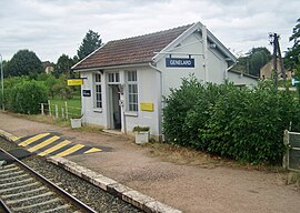 Train station | |
show Location of Génelard | |
 Génelard | |
| Coordinates: 46°34′57″N 4°14′16″E / 46.5825°N 4.2378°ECoordinates: 46°34′57″N 4°14′16″E / 46.5825°N 4.2378°E | |
| Country | France |
| Region | Bourgogne-Franche-Comté |
| Department | Saône-et-Loire |
| Arrondissement | Autun |
| Canton | Saint-Vallier |
| Intercommunality | CU Creusot Montceau |
| Government | |
| • Mayor (2020–2026) | Jean-François Jaunet[1] |
| Area 1 | 22.13 km2 (8.54 sq mi) |
| Population (Jan. 2018)[2] | 1,380 |
| • Density | 62/km2 (160/sq mi) |
| Time zone | UTC+01:00 (CET) |
| • Summer (DST) | UTC+02:00 (CEST) |
| INSEE/Postal code | 71212 /71420 |
| Elevation | 257–345 m (843–1,132 ft) (avg. 234 m or 768 ft) |
| 1 French Land Register data, which excludes lakes, ponds, glaciers > 1 km2 (0.386 sq mi or 247 acres) and river estuaries. | |


Génelard (French pronunciation: [ʒenlaʁ]) is a commune in the Saône-et-Loire department in the region of Bourgogne-Franche-Comté in eastern France.
Geography[]
The Bourbince flows southwest through the middle of the commune and crosses the village.
See also[]
References[]
- ^ Maires au 17-06-2020, data.gouv.fr, accessed 1 December 2020
- ^ "Populations légales 2018". INSEE. 28 December 2020.
| Wikimedia Commons has media related to Génelard. |
| show Authority control |
|---|
This Saône-et-Loire geographical article is a stub. You can help Wikipedia by . |
Categories:
- Communes of Saône-et-Loire
- Saône-et-Loire geography stubs