Saint-Martin-du-Mont, Saône-et-Loire
Saint-Martin-du-Mont | |
|---|---|
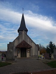 The church in Saint-Martin-du-Mont | |
show Location of Saint-Martin-du-Mont | |
 Saint-Martin-du-Mont | |
| Coordinates: 46°36′51″N 5°17′41″E / 46.6142°N 5.2947°ECoordinates: 46°36′51″N 5°17′41″E / 46.6142°N 5.2947°E | |
| Country | France |
| Region | Bourgogne-Franche-Comté |
| Department | Saône-et-Loire |
| Arrondissement | Louhans |
| Canton | Louhans |
| Area 1 | 5.26 km2 (2.03 sq mi) |
| Population (Jan. 2018)[1] | 195 |
| • Density | 37/km2 (96/sq mi) |
| Time zone | UTC+01:00 (CET) |
| • Summer (DST) | UTC+02:00 (CEST) |
| INSEE/Postal code | 71454 /71580 |
| Elevation | 181–204 m (594–669 ft) (avg. 207 m or 679 ft) |
| 1 French Land Register data, which excludes lakes, ponds, glaciers > 1 km2 (0.386 sq mi or 247 acres) and river estuaries. | |


Saint-Martin-du-Mont is a commune in the Saône-et-Loire department in the region of Bourgogne-Franche-Comté in eastern France.
Geography[]
The Vallière forms part of the commune's southern border.
See also[]
References[]
- ^ "Populations légales 2018". INSEE. 28 December 2020.
| Wikimedia Commons has media related to Saint-Martin-du-Mont (Saône-et-Loire). |
| show Authority control |
|---|
This Saône-et-Loire geographical article is a stub. You can help Wikipedia by . |
Categories:
- Communes of Saône-et-Loire
- Saône-et-Loire geography stubs