Condal
Condal | |
|---|---|
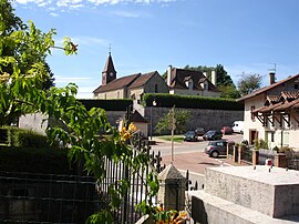 The church and surroundings in Condal | |
show Location of Condal | |
 Condal | |
| Coordinates: 46°27′42″N 5°16′57″E / 46.4617°N 5.2825°ECoordinates: 46°27′42″N 5°16′57″E / 46.4617°N 5.2825°E | |
| Country | France |
| Region | Bourgogne-Franche-Comté |
| Department | Saône-et-Loire |
| Arrondissement | Louhans |
| Canton | Cuiseaux |
| Intercommunality | Bresse Louhannaise |
| Area 1 | 16.43 km2 (6.34 sq mi) |
| Population (Jan. 2018)[1] | 450 |
| • Density | 27/km2 (71/sq mi) |
| Time zone | UTC+01:00 (CET) |
| • Summer (DST) | UTC+02:00 (CEST) |
| INSEE/Postal code | 71143 /71480 |
| Elevation | 187–230 m (614–755 ft) (avg. 210 m or 690 ft) |
| 1 French Land Register data, which excludes lakes, ponds, glaciers > 1 km2 (0.386 sq mi or 247 acres) and river estuaries. | |


Condal is a commune in the Saône-et-Loire department in the region of Bourgogne-Franche-Comté in eastern France.
Geography[]
The Solnan flows north through the middle of the commune.
See also[]
References[]
- ^ "Populations légales 2018". INSEE. 28 December 2020.
| Wikimedia Commons has media related to Condal. |
This Saône-et-Loire geographical article is a stub. You can help Wikipedia by . |
Categories:
- Communes of Saône-et-Loire
- Saône-et-Loire geography stubs