La Truchère
From Wikipedia, the free encyclopedia
Commune in Bourgogne-Franche-Comté, France
La Truchère | |
|---|---|
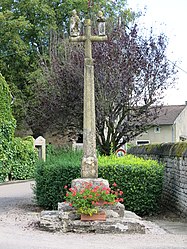 The cross in La Truchère | |
 Coat of arms | |
 La Truchère  La Truchère | |
Coordinates:  46°31′00″N 4°57′08″E / 46.5167°N 4.9522°E / 46.5167; 4.9522Coordinates: 46°31′00″N 4°57′08″E / 46.5167°N 4.9522°E / 46.5167; 4.9522 46°31′00″N 4°57′08″E / 46.5167°N 4.9522°E / 46.5167; 4.9522Coordinates: 46°31′00″N 4°57′08″E / 46.5167°N 4.9522°E / 46.5167; 4.9522 | |
| Country | France |
| Region | Bourgogne-Franche-Comté |
| Department | Saône-et-Loire |
| Arrondissement | Mâcon |
| Canton | Tournus |
| Area 1 | 5.09 km2 (1.97 sq mi) |
| Population (Jan. 2018)[1] | 220 |
| • Density | 43/km2 (110/sq mi) |
| Time zone | UTC+01:00 (CET) |
| • Summer (DST) | UTC+02:00 (CEST) |
| INSEE/Postal code | 71549 /71290 |
| Elevation | 169–179 m (554–587 ft) (avg. 185 m or 607 ft) |
| 1 French Land Register data, which excludes lakes, ponds, glaciers > 1 km2 (0.386 sq mi or 247 acres) and river estuaries. | |

La Truchère (French pronunciation: [la tʁyʃɛʁ]) is a commune in the Saône-et-Loire department in the region of Bourgogne-Franche-Comté in eastern France.
See also[]
References[]
- ^ "Populations légales 2018". INSEE. 28 December 2020.
| Wikimedia Commons has media related to La Truchère. |
Retrieved from ""
Categories:
- Communes of Saône-et-Loire
- Saône-et-Loire geography stubs
Hidden categories:
- Articles with short description
- Short description is different from Wikidata
- Coordinates on Wikidata
- Pages using infobox settlement with image map1 but not image map
- Commons category link from Wikidata
- Articles with BNF identifiers
- All stub articles
- Pages using the Kartographer extension