Chis, France
Chis | |
|---|---|
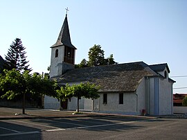 Church and village square in the center of the town | |
 Coat of arms | |
show Location of Chis | |
 Chis | |
| Coordinates: 43°17′41″N 0°07′18″E / 43.2947°N 0.1217°ECoordinates: 43°17′41″N 0°07′18″E / 43.2947°N 0.1217°E | |
| Country | France |
| Region | Occitanie |
| Department | Hautes-Pyrénées |
| Arrondissement | Tarbes |
| Canton | Bordères-sur-l'Échez |
| Intercommunality | CA Tarbes-Lourdes-Pyrénées |
| Government | |
| • Mayor (2008–2014) | Sylvie Monnery |
| Area 1 | 3.74 km2 (1.44 sq mi) |
| Population (Jan. 2018)[1] | 313 |
| • Density | 84/km2 (220/sq mi) |
| Time zone | UTC+01:00 (CET) |
| • Summer (DST) | UTC+02:00 (CEST) |
| INSEE/Postal code | 65146 /65800 |
| Elevation | 256–276 m (840–906 ft) (avg. 262 m or 860 ft) |
| 1 French Land Register data, which excludes lakes, ponds, glaciers > 1 km2 (0.386 sq mi or 247 acres) and river estuaries. | |


Chis is a commune in the Hautes-Pyrénées department in south-western France.
See also[]
References[]
- ^ "Populations légales 2018". INSEE. 28 December 2020.
| Wikimedia Commons has media related to Chis. |
This Hautes-Pyrénées geographical article is a stub. You can help Wikipedia by . |
Categories:
- Communes of Hautes-Pyrénées
- Hautes-Pyrénées geography stubs