City of Whitehorse
This article needs additional citations for verification. (August 2008) |
| City of Whitehorse Victoria | |||||||||||||||
|---|---|---|---|---|---|---|---|---|---|---|---|---|---|---|---|
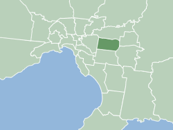 Map of Melbourne showing City of Whitehorse | |||||||||||||||
| Population | 176,196 (2018)[1] (34th) | ||||||||||||||
| • Density | 2,753/km2 (7,130/sq mi) | ||||||||||||||
| Established | December 1994 | ||||||||||||||
| Area | 64 km2 (24.7 sq mi)[1] | ||||||||||||||
| Mayor | Cr Andrew Munroe | ||||||||||||||
| Council seat | Nunawading | ||||||||||||||
| State electorate(s) | |||||||||||||||
| Federal Division(s) | |||||||||||||||
 | |||||||||||||||
| Website | City of Whitehorse | ||||||||||||||
| |||||||||||||||

The City of Whitehorse is a local government area in Victoria, Australia in the eastern suburbs of Melbourne. It has an area of 64 km2 (25 sq mi) and in June 2018, Whitehorse had a population of 176,196.[1]
Whitehorse was formed in December 1994 by the amalgamation of the former cities of Box Hill and Nunawading.[2] The name Whitehorse came from the White Horse Inn, a tavern originally located in the area in the late 19th century. This name was applied to the major thoroughfare, Whitehorse Road, which runs through the municipality today.[citation needed]
In the original proposals for council amalgamations in Melbourne, Whitehorse was a suggested name for an area comprising the City of Box Hill, with the addition of residents east of Union Road (part of the old City of Camberwell). The affected residents were unhappy, believing an alignment with Box Hill would lower the value of their properties.[citation needed] A second proposal featured the current boundaries of Whitehorse. The City of Nunawading proposed the name "City of Koornung", claiming it was more appropriate, as both cities shared the Koonung Creek, but they failed to note they had spelled Koonung incorrectly in their proposal.[citation needed] Another suggestion was "City of Deakin", as the region of Whitehorse contains both the Federal electorate of Deakin, and the Melbourne campus of Deakin University, in Burwood.[citation needed]
Councillors and wards[]
Effective from the 2020 local council elections, Whitehorse has eleven single-member wards.[3][4] The names of the eleven single-member wards are: Cootamundra, Eley, Elgar, Kingsley, Lake, Mahoneys, Simpson, Sparks, Terrara, Walker and Wattle.[5] Councillors are elected every four years to represent their ward.[6] Council elections are conducted by postal voting and votes are counted using proportional representation. Voting is compulsory for residents who are on the electoral roll for state elections, but voters aged 70 years or over are not obliged to vote at local council elections. The mayor is elected by the councillors at the first meeting of the council for a term of one year, at the end of which a council meeting is held to elect the mayor for another fixed term.
The current councillors, elected at the 2020 election, are as follows:[7]
| Party | Councillors | |
|---|---|---|
| Liberal[8] | 6 | |
| Independent | 5 | |
| Total | 11 | |
| Ward | Party | Councillor | Notes | |
|---|---|---|---|---|
| Cootamundra | Liberal | Andrew Munroe | ||
| Eley | Independent | Trudy Skilbeck | ||
| Elgar | Liberal | Blair Barker | ||
| Kingsley | Liberal | Amanda McNeill | ||
| Lake | Liberal | Denise Massoud | ||
| Mahoneys | Liberal | Mark Lane | ||
| Simpson | Independent | Prue Cutts | ||
| Sparks | Independent | Tina Liu | ||
| Terrara | Independent | Raylene Carr | ||
| Walker | Independent | Ben Stennett | ||
| Wattle | Liberal | Andrew Davenport | ||
Past councillors[]
| Previous councillors (grey shading indicates election year) [9][10][11][12][13][14] | ||||||||||||||||||||
|---|---|---|---|---|---|---|---|---|---|---|---|---|---|---|---|---|---|---|---|---|
| Ward | 00 | 01 | 02 | 03 | 04 | 05 | 06 | 07 | 08 | 09 | 10 | 11 | 12 | 13 | 14 | 15 | 16 | 17 | 18 | 19 |
| Central | Jessie McCallum | Haley WellerBYE[15] | Andrew Munroe | |||||||||||||||||
| Peter Allan | Bill Pemberton | Denise Massoud | ||||||||||||||||||
| Elgar | Bernie Millane | Helen Harris | 6. | Blair BarkerCB[16] | ||||||||||||||||
| Robert Chong | Tina Liu | |||||||||||||||||||
| Morack | Bill Bowie | Mark Lane | Bill Bennett | |||||||||||||||||
| 1. | George Droutsas | Raylene Carr | ||||||||||||||||||
| Riversdale | 2. | Sharon Ellis | ||||||||||||||||||
| 3. | John Koutras | Andrew Davenport | ||||||||||||||||||
| Springfield | Chris Aubrey | Phillip Daw | Prue Cutts | |||||||||||||||||
| Kaele Way | 4. | 5. | Ben StennettCB[17] | |||||||||||||||||
BYE denotes councillor elected at a by-election. CB denotes councillor elected via count back.
1. Noel Richard Spurr 2. Helen Buckingham 3. Richard Anderson 4. Sharon Patridge 5. Pauline Richards 6. Tanya Tescher
Suburbs[]
- Blackburn
- Blackburn North
- Blackburn South
- Box Hill
- Box Hill North
- Box Hill South
- Burwood (Shared with the City of Monash)
- Burwood East
- Forest Hill
- Mitcham
- Mont Albert (Shared with the City of Boroondara)
- Mont Albert North
- Nunawading (Shared with the City of Manningham)
- Surrey Hills (Shared with the City of Boroondara)
- Vermont (Shared with the City of Maroondah)
- Vermont South
Major thoroughfares[]


 Blackburn Road (State Route 13)
 Boronia Road (State Route 36)
 Burwood Highway (State Route 26)
 Canterbury Road (State Route 32)
 Elgar Road
 Eastern Freeway (M3)
- Highbury Road
 Maroondah Highway (Whitehorse Road) (State Route 34)
 Middleborough Road (State Route 23)
- Mitcham Road (State Route 36)
 Riversdale Road (State Route 20)
 Springvale Road (State Route 40)
 Station Street (State Route 47)
- Surrey Road (State Route 13)
 Warrigal Road (State Route 15)
Culture[]

Neighbours is filmed in Vermont South; Pin Oak Court is the real cul-de-sac that has doubled for Ramsay Street since 1985.[18][19] All of the houses featured in the show are real and the residents allow Neighbours to shoot external scenes in their front and back yards and on occasions, in their garages.[20] Owing to its association with the show, Pin Oak Court has become popular with tourists; Tours to the cul-de-sac run throughout the year.[21] The interior scenes are filmed at the Global Television studios in the adjacent suburb of Forest Hill.[22][23]
Box Hill has variously supported an eponymous brass band since 1889.
Sister city relations[]
On 12 May 1971, the City of Box Hill established a sister city relationship with Matsudo, in Chiba, Japan.[2] In December 1994, when Box Hill amalgamated with Nunawading, the City of Whitehorse re-affirmed its relationship with Matsudo.[2]
In April 2005, the City of Whitehorse signed a Memorandum of Friendship and Understanding with Shaoxing, in Zhejiang, China. The Memorandum of Friendship and Understanding aims to foster international liaisons and links and facilitate the exchange of information and personal visits, as well as to strengthen economic, tourism and educational connections between the two cities through sharing knowledge and cultural understanding.[24]
Libraries[]
All libraries in the City of Whitehorse are operated by the Whitehorse Manningham Regional Library Corporation, which also has 4 branches in the City of Manningham
- Blackburn Library – Located at Cnr Blackburn and Central Roads, Blackburn.
 Nunawading Library
 - Box Hill Library – Located at 1040 Whitehorse Road, Box Hill.
- Nunawading Library – Located at 379 Whitehorse Road, Nunawading.
- Vermont South Library – Located at Pavey Place, Vermont South.

See also[]
References[]
- ^ Jump up to: a b c "3218.0 – Regional Population Growth, Australia, 2017–18: Population Estimates by Local Government Area (ASGS 2018), 2017 to 2018". Australian Bureau of Statistics. Australian Bureau of Statistics. 27 March 2019. Retrieved 25 October 2019. Estimated resident population, 30 June 2018.
- ^ Jump up to: a b c "Matsudo Sister City". City of Whitehorse. Retrieved 18 May 2020.
- ^ "Changes To Council Electoral Structures". Premier of Victoria. Victorian Government. Retrieved 10 June 2020.
- ^ "Electoral structure changes for 2020". Local Government Victoria. Victorian Government. Retrieved 10 June 2020.
- ^ "Whitehorse Wards". City of Whitehorse. Retrieved 24 August 2020.
- ^ "Councillors and Wards". City of Whitehorse. Retrieved 21 June 2020.
- ^ "Whitehorse City Council election results 2020". www.vec.vic.gov.au. Retrieved 9 November 2020.
- ^ "City of Whitehorse Council – BURWOOD LIBERALS". Retrieved 25 December 2020.
- ^ "VEC: Whitehorse City Council Election Results 2000". 2 October 2009. Archived from the original on 2 October 2009. Retrieved 14 November 2020.
- ^ "VEC: Whitehorse City Council Election Results 2003". 2 October 2009. Archived from the original on 2 October 2009. Retrieved 14 November 2020.
- ^ "VEC: Results for the Whitehorse City Council 2005 elections". 2 October 2009. Archived from the original on 2 October 2009. Retrieved 14 November 2020.
- ^ "VEC: Whitehorse City Council Election Results 2009". 16 September 2009. Archived from the original on 16 September 2009. Retrieved 14 November 2020.
- ^ "Whitehorse City Council election results 2012 - Victorian Electoral Commission". 13 April 2019. Archived from the original on 13 April 2019. Retrieved 14 November 2020.
- ^ "Whitehorse City Council election results 2016 - Victorian Electoral Commission". 13 April 2019. Archived from the original on 13 April 2019. Retrieved 14 November 2020.
- ^ "VEC: Whitehorse City Council By-Election Results 2004". 2 October 2009. Archived from the original on 2 October 2009. Retrieved 14 November 2020.
- ^ "Countback results for the Whitehorse City Council 2017 election - Victorian Electoral Commission". 2 April 2019. Archived from the original on 2 April 2019. Retrieved 14 November 2020.
- ^ "VEC: Whitehorse City Council Countback results". 2 October 2009. Archived from the original on 2 October 2009. Retrieved 14 November 2020.
- ^ "Neighbours: 25 years young". Holy Soap. Channel 5. 18 March 2010. Archived from the original on 25 May 2010. Retrieved 25 May 2010.
- ^ "Love Thy Neighbour". Backpack Melbourne. Archived from the original on 25 May 2010. Retrieved 18 December 2009.
- ^ "Neighbours Tour FAQs". Archived from the original on 21 November 2009. Retrieved 18 December 2009.
- ^ Conrad, Peter (5 December 2004). "Why everyone wants to be Australian". The Guardian. London. Archived from the original on 28 August 2013. Retrieved 31 May 2010.
- ^ "Studios". Global TV. Archived from the original on 25 March 2009. Retrieved 20 December 2009.
- ^ "Where Is Neighbours Filmed?". Neighbours.com.au. Network Ten. Archived from the original on 6 April 2010. Retrieved 17 December 2009.
- ^ "Shaoxing Friendship Exchange Agreement". City of Whitehorse. City of Whitehorse. Retrieved 1 July 2020.
External links[]

- City of Whitehorse
- Local government areas in Melbourne