City of Melbourne
| City of Melbourne Victoria | |||||||||||||||
|---|---|---|---|---|---|---|---|---|---|---|---|---|---|---|---|
 Aerial view of the Melbourne skyline | |||||||||||||||
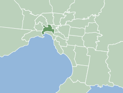 Location in Greater Melbourne | |||||||||||||||
| Population | 135,959 (2016)[1] | ||||||||||||||
| • Density | 3,606/km2 (9,340/sq mi) | ||||||||||||||
| Established | 1842 | ||||||||||||||
| Area | 37.7 km2 (14.6 sq mi)[2] | ||||||||||||||
| Lord Mayor | Sally Capp | ||||||||||||||
| Council seat | Melbourne city centre | ||||||||||||||
| Region | Central Melbourne | ||||||||||||||
| County | Bourke | ||||||||||||||
| State electorate(s) | |||||||||||||||
| Federal Division(s) | |||||||||||||||
| Website | City of Melbourne | ||||||||||||||
| |||||||||||||||


The City of Melbourne is a local government area in Victoria, Australia, located in the central city area of Melbourne. In 2018 the city has an area of 37 square kilometres (14 sq mi) and had a population of 169,961.[3] The city's motto is "Vires acquirit eundo" which means "She gathers strength as she goes."[4]
The current Lord Mayor is Sally Capp, who was elected in a by-election following the resignation of Robert Doyle on 4 February 2018. The Melbourne City Council (MCC) holds office in Melbourne Town Hall.
History[]
Melbourne was founded in 1835, during the reign of King William IV, with the arrival of the schooner Enterprize near the present site of the Queen's Wharf, as a barely legal,[clarification needed] speculative settlement that broke away from New South Wales. Unlike other Australian capital cities, Melbourne did not originate under official auspices, instead forming through the foresight of settlers from Tasmania.
Having been a province of New South Wales from its establishment in 1835, affairs of the settlement had been administered by the Parliament of New South Wales. With the growth of the settlement there had been an increasing demand by the inhabitants for greater autonomy over their own affairs. On 12 August 1842, Melbourne was incorporated as a "town" by Act 6 Victoria No. 7 of the Governor and Legislative Council of New South Wales.[5]
The town of Melbourne was raised to the status of a city by Letters Patent of Queen Victoria dated 25 June 1847, five years after its incorporation as a town. The Letters Patent also constituted the Anglican Diocese of Melbourne and declared Melbourne a cathedral city. A motion was tabled at a meeting of the Town Council to alter the style and title of Melbourne from a town to a city, a draft Bill was approved and transmitted to the Government for introduction to the Legislature. On 3 August 1849, Act 13 Victoria No. 14 was finally assented to as "An Act to effect a change in the Style and Title of the Corporation of Melbourne rendered necessary by the erection of the Town of Melbourne to a City".[6]
The city's initial boundaries, as set down in Act 8 Victoria No. 12 (19 December 1844) extended from Point Ormond in Elwood up Barkly Street and Punt Road to the Yarra River, along the river to Merri Creek at Abbotsford, then west along Brunswick Road to Moonee Ponds Creek, then south past Flemington Bridge to Princes Pier in Port Melbourne.[5] The Act imposed on the Mayor a duty to set up "permanent and conspicuous boundary marks of iron, wood, stone or other durable material" along or near the line of the Town’s boundaries—this was undertaken by Mayor James Frederick Palmer and Town Clerk John Charles King on 4 February 1846.[7]
During the 1850s, Collingwood, Fitzroy and Richmond seceded from Melbourne (all are, since 1994, part of the City of Yarra), as did South Melbourne, whilst other parts became parts of the neighbouring districts of St Kilda and Port Melbourne, and the border between Brunswick and Melbourne moved south one block to Park Street.[5]
On 18 December 1902, King Edward VII conferred the title "Lord Mayor" on the mayor of the City of Melbourne.
On 30 October 1905, Melbourne absorbed two neighbouring council areas. Now included in the City was the Borough of Flemington and Kensington which had been formed in 1882 when it broke away from the City of Essendon. The second, the Town of North Melbourne, formerly known as Hotham, had been established on 30 September 1859 and been granted town status on 18 December 1874. Both town halls are still in use today as public buildings—the former in Kensington near the present-day Newmarket railway station; the latter in Errol Street, North Melbourne.
The Melbourne and Geelong Corporations Act 1938 allowed for three councillors for each of the eleven wards, with a general election held on 24 August 1939. Following a recommendation by the Local Government Advisory Board in 1978, an Order in Council (27 February 1979, effective from 19 May 1979) reduced this to eight wards. In December 1980, the Hamer Government dismissed the council, and appointed three Commissioners to determine how the boundaries could best be altered to produce more effective local government, with special regard to Melbourne's central business district and its importance to the state, as well as to advise changes needed to the constitution, structure, functions and administration. However, in 1982, with the election of a new Labor government under John Cain, the Act establishing the commission was repealed, and the Melbourne Corporation (Election of Council) Act 1982 established six wards, for which an election was held on 4 December 1982. Three years later, an additional ward was added.[5]
In 1993, the City of Melbourne Act specified changes to the boundaries which saw Melbourne gain Southbank and the Victorian Arts Centre on 18 November 1993, and the city was resubdivided into four wards – Flagstaff, University, Hoddle and Domain. The wards were abolished in 2001, with the council having an elected Lord Mayor with a Deputy Lord Mayor and seven other councillors.[7] In 2012, the number of Councillors was increased to nine, in addition to the Lord Mayor and Deputy Lord Mayor.
In 2005, the council announced the construction of a new 6-star environmental office building, Council House 2, in Little Collins Street.
On 2 July 2007, the City of Melbourne almost doubled in size when the suburb of Docklands was added to its jurisdiction, having been previously transferred from the administration of the State Government.
In July 2009, Lord Mayor Robert Doyle unveiled a new corporate identity for the City of Melbourne, costing $239,558.[8]
Suburbs[]
- Carlton
- Carlton North (shared with the City of Yarra)
- Docklands
- East Melbourne
- Flemington (shared with the City of Moonee Valley)
- Jolimont
- Kensington
- Melbourne
- North Melbourne
- Port Melbourne (shared with the City of Port Phillip)
- Parkville (shared with the City of Moreland)
- Southbank
- South Wharf (shared with the City of Port Phillip)
- South Yarra (shared with the City of Stonnington)
- West Melbourne
Composition of current Council[]

The City of Melbourne is an unsubdivided municipality consisting of a directly elected Lord Mayor and Deputy Lord Mayor, and nine Councillors.[9] Since 2008, all Victorian councillors serve a four year term. The next general election will be held on Saturday 24 October 2020.
During a general election, the City of Melbourne holds two simultaneous elections – one to elect the Lord Mayor and Deputy Lord Mayor (leadership team) and the other to elect the nine councillors.[9] All residents are entitled to vote in the election, as well as up to two of each of the following: non-residential owners and occupiers of rateable property. If a corporation solely owns or occupies rateable property in the municipality, then the corporation must appoint two company officers (director and/or company secretary, or equivalent) to represent it and vote on its behalf.
The current makeup of the Council is:[10]
| Party | Councillors | |
|---|---|---|
| Team Sally Capp | 4 | |
| Greens | 2 | |
| Team Arron Wood | 1 | |
| Labor | 1 | |
| Bring Back Melbourne | 1 | |
| Team Hakim | 1 | |
| Back to Business | 1 | |
| Total | 11 | |
| Party | Councillor | Notes | |
|---|---|---|---|
| Team Sally Capp | Sally Capp | Mayor | |
| Team Sally Capp | Nicholas Reece | Deputy Mayor | |
| Team Sally Capp | Kevin Louey | ||
| Greens | Rohan Leppert | ||
| Team Arron Wood | Jason Chang | ||
| Labor | Davydd Griffiths | ||
| Team Sally Capp | Roshena Campbell | ||
| Greens | Olivia Ball | ||
| Bring Back Melbourne | Philip Le Liu | ||
| Team Hakim | Jamal Hakim | ||
| Back to Business | Elizabeth Mary Doidge | ||
Demographics[]
| Selected historical census data for City of Melbourne local government area | ||||||
|---|---|---|---|---|---|---|
| Census year | 2001[11] | 2006[12] | 2011[13] | 2016[14] | ||
| Population | Estimated residents on census night | 60,745 | 71,380 | 93,625 | 135,959 | |
| LGA rank in terms of size within Victoria | 30th | |||||
| % of Victoria population | 1.32% | |||||
| % of Australian population | 0.32% | |||||
| Cultural and language diversity | ||||||
| Ancestry, top responses |
Chinese | 17.1% | ||||
| English | 16.8% | |||||
| Australian | 12.7% | |||||
| Irish | 7.3% | |||||
| Scottish | 5.6% | |||||
| Language, top responses (other than English) |
Mandarin | 4.7% | ||||
| Cantonese | 4.7% | |||||
| Indonesian | 3.1% | |||||
| Italian | 1.8% | |||||
| Vietnamese | 1.3% | |||||
| Korean | 1.2% | |||||
| Arabic | 1.5% | |||||
| Spanish | 1.7% | |||||
| Religious affiliation | ||||||
| Religious affiliation, top responses |
No religion | 21.1% | ||||
| Catholic | 20.2% | |||||
| Anglican | 11.9% | |||||
| Buddhism | 6.2% | |||||
| Uniting | 4.0% | |||||
| Islam | 3.5% | |||||
| Hinduism | 4.0% | |||||
| Median weekly incomes | ||||||
| Personal income | Median weekly personal income | A$566 | A$711 | A$642 | ||
| % of Australian median income | 121.5% | 123.2% | 97.0% | |||
| Family income | Median weekly family income | A$1627 | A$1962 | A$2062 | ||
| % of Australian median income | 138.9% | 132.5% | 118.9% | |||
| Household income | Median weekly household income | A$1081 | A$1352 | A$1354 | ||
| % of Australian median income | 105.3% | 109.6% | 94.2% | |||
| Dwelling structure | ||||||
| Dwelling type | Separate house | 5.6% | ||||
| Semi-detached, terrace or townhouse | 21.1% | 16.6% |
||||
| Flat or apartment | 70.4% | |||||
Population of the urban area[]
| Year | 1954 | 1958 | 1961 | 1966 | 1971 | 1976 | 1981 | 1986 | 1991 | 1996 | 2001 | 2006 | 2011 | 2016 |
|---|---|---|---|---|---|---|---|---|---|---|---|---|---|---|
| Population | 93,172 | 89,800* | 76,810 | 75,709 | 75,830 | 65,167 | 59,100* | 56,100* | 38,504 | 45,253 | 60,745 | 71,380 | 93,625 | 135,959 |
* Estimates in 1958, 1983 and 1988 Victorian Year Books.
Railway stations[]

|
Other |
Schools[]
Private[]
- Eltham College – Year 9 City Campus
- Melbourne Grammar School
- Melbourne Girls' Grammar School
- Wesley College – St Kilda Road Campuses
- Haileybury College - City Campus
Public[]
- University High School
- South Yarra Primary School
- Carlton Gardens Primary School
Catholic[]
Sister cities[]

The City of Melbourne has six sister cities.[15] They are:
|
Some other local councils in the Melbourne metropolitan area have sister city relationships; see Local Government Areas of Victoria.
See also[]
References[]
- ^ "Residents Profiles". melbourne.vic.gov.au. City of Melbourne. Retrieved 3 March 2021.
- ^ "Residents Profiles". melbourne.vic.gov.au. City of Melbourne. Retrieved 3 March 2021.
- ^ "3218.0 – Regional Population Growth, Australia, 2017-18: Population Estimates by Local Government Area (ASGS 2018), 2017 to 2018". Australian Bureau of Statistics. Australian Bureau of Statistics. 27 March 2019. Retrieved 25 October 2019. Estimated resident population, 30 June 2018.
- ^ "Coat of arms". City of Melbourne. Retrieved 5 June 2020.
- ^ Jump up to: a b c d Victorian Municipal Directory. Brunswick: Arnall & Jackson. 1992. pp. 275–278. Accessed at State Library of Victoria, La Trobe Reading Room.
- ^ City of Melbourne. "History and heritage – Melbourne becomes a city". Archived from the original on 28 August 2004. Retrieved 20 December 2007.
- ^ Jump up to: a b City of Melbourne (November 1997). "The History of the City of Melbourne" (PDF). pp. 40–43. Retrieved 26 August 2018.
- ^ "A new icon for global Melbourne". City of Melbourne. Retrieved 11 January 2010.
- ^ Jump up to: a b "Council, mayor and lord mayor history". City Of Melbourne. Retrieved 5 June 2020.
- ^ "Melbourne City Council election results 2020". www.vec.vic.gov.au. Retrieved 6 November 2020.
- ^ Australian Bureau of Statistics (9 March 2006). "City of Melbourne (C)". 2001 Census QuickStats. Retrieved 6 December 2017.
- ^ Australian Bureau of Statistics (25 October 2007). "City of Melbourne (C)". 2006 Census QuickStats. Retrieved 6 December 2017.
- ^ Australian Bureau of Statistics (31 October 2012). "City of Melbourne (C)". 2011 Census QuickStats. Retrieved 6 December 2017.

- ^ Australian Bureau of Statistics (27 June 2017). "Melbourne (C)". 2016 Census QuickStats. Retrieved 15 November 2017.
- ^ "City of Melbourne — International connections — Sister cities". City of Melbourne. Archived from the original on 22 August 2016. Retrieved 29 July 2016.
External links[]
| Wikimedia Commons has media related to City of Melbourne. |
| Wikivoyage has a travel guide for Melbourne's City Centre. |
- Official City of Melbourne website
- What's On
- Metlink local public transport map
- Local history of the city of Melbourne
- Enterprize – Melbourne's Tall Ship
- Link to Land Victoria interactive maps
| show Authority control |
|---|
Coordinates: 37°48′49″S 144°57′47″E / 37.81361°S 144.96306°E

- Populated places established in 1842
- 1842 establishments in Australia
- City of Melbourne
- Local government areas in Melbourne