Surf Coast Shire
| Surf Coast Shire Victoria | |||||||||||||||
|---|---|---|---|---|---|---|---|---|---|---|---|---|---|---|---|
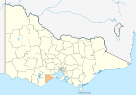 Location in Victoria | |||||||||||||||
| Population | 32,251 (2018)[1] | ||||||||||||||
| • Density | 20.767/km2 (53.786/sq mi) | ||||||||||||||
| Established | 1994 | ||||||||||||||
| Gazetted | 9 March 1994[2] | ||||||||||||||
| Area | 1,553 km2 (599.6 sq mi)[1] | ||||||||||||||
| Mayor | Cr Rose Hodge | ||||||||||||||
| Council seat | Torquay | ||||||||||||||
| Region | Barwon South West | ||||||||||||||
| State electorate(s) | |||||||||||||||
| Federal Division(s) | Corangamite | ||||||||||||||
| Website | Surf Coast Shire | ||||||||||||||
| |||||||||||||||
The Surf Coast Shire is a local government area in the Barwon South West region of Victoria, Australia, located in the south-western part of the state. It covers an area of 1,553 square kilometres (600 sq mi) and in June 2018 had a population of 32,251.[1] It includes the towns of Aireys Inlet, Anglesea, Lorne, Moriac, Torquay and Winchelsea. It was formed in 1994 from the amalgamation of the Shire of Winchelsea, Shire of Barrabool and part of the former City of South Barwon, which was, at that point, part of the City of Greater Geelong.[2][3]
The Shire is governed and administered by the Surf Coast Shire Council; its seat of local government and administrative centre is located at the council headquarters in Torquay. The Shire is named after its location on the popular surf coast of Victoria.
Post-2008, following an electoral representation review, the decision was made to re-subdivide the municipality into four wards, the current wards are Torquay, Anglesea, Winchelsea and Lorne. Between 2004 and 2008, the Shire was an unsubdivided municipality and as a result, the entire municipality voted to elect nine councillors. Between 1996 and 2004, the municipality was subdivided into six wards, where three councillors per ward were elected from the Torquay and Anglesea wards, and one councillor per ward was elected from the Lorne, Winchelsea, Moriac and Aireys Inlet wards. A position of Deputy Mayor was created in 2004, but it was abolished for the 2005 mayoral election.
Council[]
Current composition[]
The council is composed of four wards and nine councillors, with four councillors elected to represent the Torquay Ward, two councillors per ward elected to represent each of the Anglesea and Winchelsea wards, and one councillor elected to represent the Lorne Ward.[4]
| Ward | Councillor | Notes | |
|---|---|---|---|
| Anglesea | Tony Revell | ||
| Margot Smith | |||
| Lorne | Clive Goldsworthy | ||
| Torquay | David Bell | ||
| Martin Duke | |||
| Rose Hodge | Mayor | ||
| Brian McKiterick | |||
| Winchelsea | James McIntyre | ||
| Heather Wellington | |||
List of former and current mayors[]
- Cr Noel Bates (1995–1997)
- Cr Henry Love (1997–1998)
- Cr Julie Hansen (1998–2000)
- Cr Mike Barrow (2000–2001)
- Cr Beth Davidson (2001–2004)
- Cr Keith Grossman (2004–2005)
- Cr Libby Mears (2005–2006)
- Cr Rose Hodge (2006–2007)
- Cr Dean Webster (2007–2008)
- Cr Libby Mears (2008–2009)
- Cr Libby Coker (2009–2010)
- Cr Dean Webster (2010–2011)
- Cr Brian McKiterick (2011–2012)
- Cr Libby Coker (2012–2013)
- Cr Rose Hodge (2013–2014)
- Cr Margot Smith (2014–2015)
- Cr Rose Hodge (2015–2016)
- Cr Brian McKiterick (2016-2017)
- Cr David Bell (2017-2018)
- Cr Rose Hodge (2018–present)
Administration and Governance[]
The council meets in the council chambers at the council headquarters in the Torquay Municipal Offices, which is also the location of the council's administrative activities. It also provides customer services at its Municipal Office in Torquay.
Elections[]
Surf Coast Shire holds elections every 4 years to determine the composition of the council.
2016 election[]
Anglesea Ward[]
| Party | Candidate | Votes | % | ±% | |
|---|---|---|---|---|---|
| Labor | Libby Coker | 2,504 | 48.5 | ||
| Independent | Margot Ann Smith | 1,393 | 27.0 | ||
| Independent | Jenna Robinson | 1,268 | 24.6 | ||
| Turnout | 6,891 | 76.2 | |||
| Registered electors | 5,165 | ||||
| Labor hold | Swing | ||||
| Independent hold | Swing | ||||
Lorne Ward[]
Lorne Ward was uncontested in the 2016 election, with Councillor Clive Goldsworthy being re-elected unopposed.
Torquay Ward[]
| Party | Candidate | Votes | % | ±% | |
|---|---|---|---|---|---|
| Labor | Rose Hodge | 2,866 | 27.2 | ||
| Independent | David Bell | 1,962 | 18.6 | ||
| Liberal | Brian McKiterick | 1,683 | 16.0 | ||
| Greens | Marian Smedley[5][6][7] | 1,529 | 14.5 | ||
| Independent | Martin Paul Duke | 1,522 | 14.2 | ||
| Independent | Joe Remenyi | 993 | 9.4 | ||
| Turnout | 10,555 | 70.9 | |||
| Registered electors | 15,308 | ||||
| Labor hold | Swing | ||||
| Independent hold | Swing | ||||
| Liberal hold | Swing | ||||
| Independent gain from Greens | Swing | ||||
Main towns in shire[]
In June 2018 the shire had a population of 32,251.
| Population | |
| Locality | Total |
| Aireys Inlet | 802 |
| Anglesea | 2,545 |
| Bambra | 101 |
| Barrabool | 235 |
| Bellbrae | 865 |
| Bells Beach | 130 |
| Benwerrin | 5 |
| Big Hill | 31 |
| Population | |
| Locality | Total |
| Boonah | 21 |
| Breamlea | 162 |
| Buckley | 211 |
| Deans Marsh | 269 |
| Eastern View | 35 |
| Fairhaven | 296 |
| Freshwater Creek | 414 |
| Gherang | 370 |
| Population | |
| Locality | Total |
| Gnarwarre | 267 |
| Jan Juc | 3,683 |
| Lorne | 1,114 |
| Modewarre | 276 |
| Moggs Creek | 89 |
| Moriac | 782 |
| Mount Duneed | 1,578 |
| Mount Moriac | 240 |
| Population | |
| Locality | Total |
| Ombersley | 97 |
| Paraparap | 151 |
| Pennyroyal | 86 |
| Torquay | 13,258 |
| Wensleydale | 107 |
| Winchelsea | 1,954 |
| Winchelsea South | 179 |
| Wurdiboluc | 138 |
See also[]
List of localities (Victoria)
References[]
- ^ Jump up to: a b c "3218.0 – Regional Population Growth, Australia, 2017-18: Population Estimates by Local Government Area (ASGS 2018), 2017 to 2018". Australian Bureau of Statistics. Australian Bureau of Statistics. 27 March 2019. Retrieved 25 October 2019. Estimated resident population, 30 June 2018.
- ^ Jump up to: a b Victoria Government Gazette – Online Archive (1837–1997). "Orders estg the Surf Coast Shire: S8 of 1994". State Library of Victoria. State Government of Victoria (published 9 March 1994). pp. 1–9. Retrieved 10 January 2014.
- ^ Victoria Government Gazette – Online Archive (1837–1997). "Order altg (Part 8) the Surf Coast Shire: S63 of 1994". State Library of Victoria. State Government of Victoria (published 23 September 1994). p. 6. Retrieved 10 January 2014.
- ^ Local Government in Victoria. "Surf Coast Shire Council". Department of Transport, Planning and Local Infrastructure. State Government of Victoria. Retrieved 10 January 2014.
- ^ https://www.geelongadvertiser.com.au/news/geelong/who-is-standing-in-the-local-council-elections/news-story/1d5a3103449655629af077db194ac10d
- ^ https://greens.org.au/vic/person/marian-smedley
- ^ https://freelocalnews.com.au/surfcoasttimes/news/marian-smedley-to-stand-in-south-barwon/
External links[]
- Surf Coast Shire Council official website
- Great Ocean Road Journey, Victoria, Australia (replaces the Surf Coast Tourist website)
- Metlink local public transport map
- Link to Land Victoria interactive maps
- The Anglesea & District Historical Society Inc.
| show Authority control |
|---|
Coordinates: 38°18′00″S 144°00′00″E / 38.30000°S 144.00000°E

- Populated places established in 1994
- 1994 establishments in Australia
- Local government areas of Victoria (Australia)
- Barwon South West