Shire of Hepburn
| Hepburn Shire Council Victoria | |||||||||||||||
|---|---|---|---|---|---|---|---|---|---|---|---|---|---|---|---|
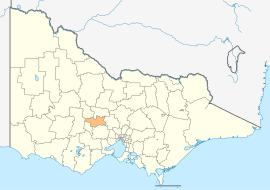 Location in Victoria | |||||||||||||||
| Population | 15,812 (2018)[1] | ||||||||||||||
| • Density | 10.735/km2 (27.802/sq mi) | ||||||||||||||
| Established | 1995 | ||||||||||||||
| Gazetted | 19 January 1995[2] | ||||||||||||||
| Area | 1,473 km2 (568.7 sq mi)[1] | ||||||||||||||
| Mayor | Cr | ||||||||||||||
| Council seat | Daylesford | ||||||||||||||
| Region | Western Victoria | ||||||||||||||
| State electorate(s) | |||||||||||||||
| Federal division(s) | Ballarat | ||||||||||||||
| Website | Hepburn Shire Council | ||||||||||||||
| |||||||||||||||
The Shire of Hepburn is a local government area in Victoria, Australia, located in the central part of the state. It covers an area of 1,473 square kilometres (569 sq mi) and, in June 2018 had a population of 15,812.[1]
It includes the towns of Clunes, Creswick, Daylesford, Hepburn Springs and Trentham and the villages of Glenlyon, Allendale, Kingston, Leonard's Hill, Lyonville, Newlyn, Denver and Smeaton.
It was formed in 1995 from the amalgamation of the Shire of Creswick, Shire of Daylesford and Glenlyon and parts of the Shire of Kyneton and Shire of Talbot and Clunes.[2]
The Shire is governed and administered by the Hepburn Shire Council; its seat of local government and administrative centre is located at the council headquarters in Daylesford, it also has a service centre located in Creswick. The Shire is named after an early squatter named John Hepburn, who established the Smeaton Hill pastoral run, which was located a few kilometres north of present-day Creswick.[3]
Council[]
Current composition[]
The council is composed of five wards and seven councillors, with two councillors per ward elected to represent each of the Creswick and Birch wards, and one councillor per remaining ward elected to represent each of the other wards. As of 2020, the current councillors are:[4]
| Ward | Party | Councillor | Notes | |
|---|---|---|---|---|
| Birch | Independent | Jen Bray | ||
| Independent | Lesley Hewitt | |||
| Cameron | Independent | Tessa Halliday | ||
| Coliban | Independent | Brian Hood | ||
| Creswick | Independent | Don Henderson | ||
| Independent | Tim Drylie | |||
| Holcombe | Independent | Juliet Simpson | ||
Administration and governance[]
The council meets in the council chambers at the council headquarters in the Daylesford Municipal Offices, which is also the location of the council's administrative activities. It also provides customer services at both its administrative centre in Daylesford, and its service centre in Creswick.
Towns and localities[]
| Population | |
| Locality | Total |
| Allendale | 166 |
| Bald Hills | 107 |
| 10 | |
| Blampied | 212 |
| 228 | |
| 99 | |
| Bullarto | 73 |
| 33 | |
| 18 | |
| Campbelltown | 55 |
| Clunes | 1,728 |
| Clydesdale | 58 |
| 252 | |
| Creswick | 3,170 |
| 58 | |
| Daylesford | 2,548 |
| Dean | 120 |
| Denver | 150 |
| Population | |
| Locality | Total |
| Drummond | 283 |
| 25 | |
| 58 | |
| Eganstown | 203 |
| 37 | |
| 131 | |
| 104 | |
| Franklinford | 66 |
| 13 | |
| Glenlyon | 389 |
| Guildford | 333 |
| 599 | |
| Hepburn Springs | 329 |
| Invermay | 835 |
| Kingston | 177 |
| 28 | |
| 168 | |
| 21 | |
| Population | |
| Locality | Total |
| 17 | |
| Leonards Hill | 45 |
| 62 | |
| Lyonville | 175 |
| 89 | |
| 89 | |
| 41 | |
| Musk | 150 |
| 132 | |
| Newbury | 71 |
| Newlyn | 128 |
| 174 | |
| North Blackwood | 51 |
| 122 | |
| 62 | |
| Sailors Falls | 62 |
| 81 | |
| Sandon | 81 |
| Population | |
| Locality | Total |
| Shepherds Flat | 66 |
| Smeaton | 231 |
| 31 | |
| 198 | |
| 181 | |
| Stony Creek | 6 |
| Strangways | 87 |
| Sulky | 232 |
| 21 | |
| Trentham | 1,180 |
| Trentham East | 153 |
| 34 | |
| Waubra | 275 |
| Wattle Flat | 97 |
| 46 | |
| 241 | |
| Yandoit | 154 |
| 28 | |
Traditional owners[]
The traditional owners of the Shire of Hepburn are the dja dja wurrung.[5]
References[]
- ^ a b c "3218.0 – Regional Population Growth, Australia, 2017-18: Population Estimates by Local Government Area (ASGS 2018), 2017 to 2018". Australian Bureau of Statistics. Australian Bureau of Statistics. 27 March 2019. Retrieved 25 October 2019. Estimated resident population, 30 June 2018.
- ^ a b Victoria Government Gazette – Online Archive (1837–1997). "S2 of 1995: Order estg (Part 6) the Shire of Hepburn". State Library of Victoria. State Government of Victoria (published 19 January 1995). p. 3. Retrieved 10 January 2014.
- ^ Hepburn Shire Council. "Hepburn Shire – A Brief Profile". Hepburn Shire Council. Retrieved 14 December 2013.
- ^ "Hepburn Shire Council election results 2020". www.vec.vic.gov.au. Retrieved 11 November 2020.
- ^ "Cultural Diversity & Heritage". Hepburn Shire Council. Retrieved 2 May 2021.
External links[]
Coordinates: 37°18′50″S 144°08′16″E / 37.31389°S 144.13778°E

This Australian government-related article is a stub. You can help Wikipedia by . |
This article about a location in Grampians (region) is a stub. You can help Wikipedia by . |
- Populated places established in 1995
- 1995 establishments in Australia
- Local government areas of Victoria (Australia)
- Grampians (region)
- Shire of Hepburn
- Australia government stubs
- Grampians (region) geography stubs