Concoules
Concoules | |
|---|---|
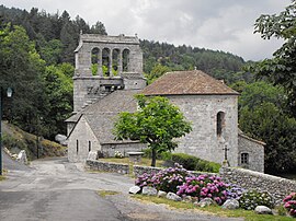 The church of Concoules | |
 Coat of arms | |
show Location of Concoules | |
 Concoules | |
| Coordinates: 44°23′01″N 3°56′17″E / 44.3836°N 3.938°ECoordinates: 44°23′01″N 3°56′17″E / 44.3836°N 3.938°E | |
| Country | France |
| Region | Occitanie |
| Department | Gard |
| Arrondissement | Alès |
| Canton | La Grand-Combe |
| Intercommunality | Alès Agglomération |
| Government | |
| • Mayor (2020–2026) | Jean-Marie Malaval[1] |
| Area 1 | 16.47 km2 (6.36 sq mi) |
| Population (Jan. 2018)[2] | 259 |
| • Density | 16/km2 (41/sq mi) |
| Time zone | UTC+01:00 (CET) |
| • Summer (DST) | UTC+02:00 (CEST) |
| INSEE/Postal code | 30090 /30450 |
| Elevation | 355–1,507 m (1,165–4,944 ft) (avg. 630 m or 2,070 ft) |
| 1 French Land Register data, which excludes lakes, ponds, glaciers > 1 km2 (0.386 sq mi or 247 acres) and river estuaries. | |


Concoules is a commune in the Gard department in southern France.
Population[]
| Year | Pop. | ±% |
|---|---|---|
| 1793 | 899 | — |
| 1821 | 830 | −7.7% |
| 1846 | 790 | −4.8% |
| 1872 | 646 | −18.2% |
| 1901 | 485 | −24.9% |
| 1926 | 357 | −26.4% |
| 1946 | 324 | −9.2% |
| 1962 | 261 | −19.4% |
| 1968 | 238 | −8.8% |
| 1975 | 262 | +10.1% |
| 1982 | 241 | −8.0% |
| 1990 | 236 | −2.1% |
| 1999 | 256 | +8.5% |
| 2008 | 260 | +1.6% |
See also[]
- Communes of the Gard department
References[]
- ^ "Répertoire national des élus: les maires". data.gouv.fr, Plateforme ouverte des données publiques françaises (in French). 2 December 2020. Retrieved 7 December 2020.
- ^ "Populations légales 2018". INSEE. 28 December 2020.
| Wikimedia Commons has media related to Concoules. |
| show Communes of the Gard department |
|---|
| show Authority control |
|---|
This Gard geographical article is a stub. You can help Wikipedia by . |
Categories:
- Communes of Gard
- Gard geography stubs