Courgenard
Courgenard | |
|---|---|
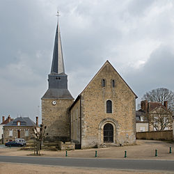 The church of Saint Martin | |
show Location of Courgenard | |
 Courgenard | |
| Coordinates: 48°09′08″N 0°44′11″E / 48.1521°N 0.7365°ECoordinates: 48°09′08″N 0°44′11″E / 48.1521°N 0.7365°E | |
| Country | France |
| Region | Pays de la Loire |
| Department | Sarthe |
| Arrondissement | Mamers |
| Canton | Saint-Calais |
| Intercommunality | Pays de l'Huisne Sarthoise |
| Government | |
| • Mayor (2020–2026) | Thierry Renvoizé[1] |
| Area 1 | 11.32 km2 (4.37 sq mi) |
| Population (Jan. 2018)[2] | 496 |
| • Density | 44/km2 (110/sq mi) |
| Demonym(s) | Cosnellien, Cosnellienne |
| Time zone | UTC+01:00 (CET) |
| • Summer (DST) | UTC+02:00 (CEST) |
| INSEE/Postal code | 72105 /72320 |
| 1 French Land Register data, which excludes lakes, ponds, glaciers > 1 km2 (0.386 sq mi or 247 acres) and river estuaries. | |


Courgenard is a commune in the Sarthe department in the Pays de la Loire region in north-western France.
See also[]
- Communes of the Sarthe department
References[]
- ^ "Répertoire national des élus: les maires". data.gouv.fr, Plateforme ouverte des données publiques françaises (in French). 2 December 2020.
- ^ "Populations légales 2018". INSEE. 28 December 2020.
| Wikimedia Commons has media related to Courgenard. |
| show Communes of the Sarthe department |
|---|
| show Authority control |
|---|
This Sarthe geographical article is a stub. You can help Wikipedia by . |
Categories:
- Communes of Sarthe
- Sarthe geography stubs