Crazannes
show This article may be expanded with text translated from the corresponding article in French. (December 2008) Click [show] for important translation instructions. |
Crazannes | |
|---|---|
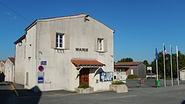 The town hall in Crazannes | |
show Location of Crazannes | |
 Crazannes | |
| Coordinates: 45°50′56″N 0°42′16″W / 45.8489°N 0.7044°WCoordinates: 45°50′56″N 0°42′16″W / 45.8489°N 0.7044°W | |
| Country | France |
| Region | Nouvelle-Aquitaine |
| Department | Charente-Maritime |
| Arrondissement | Saintes |
| Canton | Saint-Porchaire |
| Intercommunality | Cœur de Saintonge |
| Government | |
| • Mayor (2008–2014) | Gérard Gaillard |
| Area 1 | 4.81 km2 (1.86 sq mi) |
| Population (Jan. 2018)[1] | 433 |
| • Density | 90/km2 (230/sq mi) |
| Time zone | UTC+01:00 (CET) |
| • Summer (DST) | UTC+02:00 (CEST) |
| INSEE/Postal code | 17134 /17350 |
| Elevation | 2–28 m (6.6–91.9 ft) |
| 1 French Land Register data, which excludes lakes, ponds, glaciers > 1 km2 (0.386 sq mi or 247 acres) and river estuaries. | |


Crazannes is a commune in the Charente-Maritime department in southwestern France.
Population[]
| Year | Pop. | ±% |
|---|---|---|
| 1962 | 304 | — |
| 1968 | 298 | −2.0% |
| 1975 | 328 | +10.1% |
| 1982 | 361 | +10.1% |
| 1990 | 357 | −1.1% |
| 1999 | 409 | +14.6% |
| 2008 | 445 | +8.8% |
See also[]
References[]
- ^ "Populations légales 2018". INSEE. 28 December 2020.
| Wikimedia Commons has media related to Crazannes. |
| show Authority control |
|---|
This Charente-Maritime geographical article is a stub. You can help Wikipedia by . |
Categories:
- Communes of Charente-Maritime
- Charente-Maritime geography stubs