Curnier
Curnier | |
|---|---|
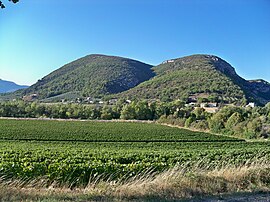 A vineyard at Curnier | |
show Location of Curnier | |
 Curnier | |
| Coordinates: 44°23′09″N 5°14′06″E / 44.3858°N 5.235°ECoordinates: 44°23′09″N 5°14′06″E / 44.3858°N 5.235°E | |
| Country | France |
| Region | Auvergne-Rhône-Alpes |
| Department | Drôme |
| Arrondissement | Nyons |
| Canton | Nyons et Baronnies |
| Government | |
| • Mayor (2008–2014) | Claude Laget |
| Area 1 | 8 km2 (3 sq mi) |
| Population (Jan. 2018)[1] | 189 |
| • Density | 24/km2 (61/sq mi) |
| Time zone | UTC+01:00 (CET) |
| • Summer (DST) | UTC+02:00 (CEST) |
| INSEE/Postal code | 26112 /26110 |
| Elevation | 313–742 m (1,027–2,434 ft) |
| 1 French Land Register data, which excludes lakes, ponds, glaciers > 1 km2 (0.386 sq mi or 247 acres) and river estuaries. | |


Curnier is a commune in the Drôme department in southeastern France.
Population[]
| Year | Pop. | ±% |
|---|---|---|
| 1911 | 203 | — |
| 1962 | 108 | −46.8% |
| 1968 | 133 | +23.1% |
| 1975 | 145 | +9.0% |
| 1982 | 132 | −9.0% |
| 1990 | 179 | +35.6% |
| 1999 | 186 | +3.9% |
| 2008 | 204 | +9.7% |
See also[]
References[]
- ^ "Populations légales 2018". INSEE. 28 December 2020.
| Wikimedia Commons has media related to Curnier. |
| show Authority control |
|---|
This Drôme geographical article is a stub. You can help Wikipedia by . |
Categories:
- Communes of Drôme
- Drôme geography stubs