Faugères, Ardèche
This article may be expanded with text translated from the corresponding article in French. (December 2008) Click [show] for important translation instructions.
|
Faugères | |
|---|---|
Commune | |
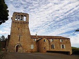 The church in Faugères | |
Location of Faugères  | |
 Faugères | |
| Coordinates: 44°28′32″N 4°08′11″E / 44.4756°N 4.1364°ECoordinates: 44°28′32″N 4°08′11″E / 44.4756°N 4.1364°E | |
| Country | France |
| Region | Auvergne-Rhône-Alpes |
| Department | Ardèche |
| Arrondissement | Largentière |
| Canton | Les Cévennes ardéchoises |
| Intercommunality | Pays Beaume Drobie |
| Government | |
| • Mayor (2020–2026) | Michel Di Vuolo |
| Area 1 | 5.99 km2 (2.31 sq mi) |
| Population (Jan. 2018)[1] | 98 |
| • Density | 16/km2 (42/sq mi) |
| Time zone | UTC+01:00 (CET) |
| • Summer (DST) | UTC+02:00 (CEST) |
| INSEE/Postal code | 07088 /07230 |
| Elevation | 299–811 m (981–2,661 ft) (avg. 400 m or 1,300 ft) |
| 1 French Land Register data, which excludes lakes, ponds, glaciers > 1 km2 (0.386 sq mi or 247 acres) and river estuaries. | |


Faugères (French pronunciation: [foʒɛʁ] (![]() listen); Occitan: Faugièiras) is a commune in the Ardèche department in southern France.
listen); Occitan: Faugièiras) is a commune in the Ardèche department in southern France.
Population[]
| Year | Pop. | ±% |
|---|---|---|
| 1962 | 115 | — |
| 1968 | 122 | +6.1% |
| 1975 | 122 | +0.0% |
| 1982 | 120 | −1.6% |
| 1990 | 106 | −11.7% |
| 1999 | 101 | −4.7% |
| 2008 | 89 | −11.9% |
See also[]
References[]
- ^ "Populations légales 2018". The National Institute of Statistics and Economic Studies. 28 December 2020.
| Wikimedia Commons has media related to Faugères, Ardèche. |
This Ardèche geographical article is a stub. You can help Wikipedia by . |
Categories:
- Communes of Ardèche
- Ardèche geography stubs