Hůry
Hůry | |
|---|---|
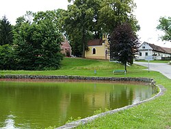 Chapel of Saint Florian in the centre of Hůry | |
 Flag  Coat of arms | |
 Hůry Location in the Czech Republic | |
| Coordinates: 49°0′24″N 14°32′28″E / 49.00667°N 14.54111°ECoordinates: 49°0′24″N 14°32′28″E / 49.00667°N 14.54111°E | |
| Country | |
| Region | South Bohemian |
| District | České Budějovice |
| First mentioned | 1378 |
| Area | |
| • Total | 5.34 km2 (2.06 sq mi) |
| Elevation | 467 m (1,532 ft) |
| Population (2021-01-01)[1] | |
| • Total | 615 |
| • Density | 120/km2 (300/sq mi) |
| Time zone | UTC+1 (CET) |
| • Summer (DST) | UTC+2 (CEST) |
| Postal code | 373 71 |
| Website | www |

Hůry is a municipality and village in České Budějovice District in the South Bohemian Region of the Czech Republic. It has about 600 inhabitants.
Hůry lies approximately 6 kilometres (4 mi) north-east of České Budějovice and 121 km (75 mi) south of Prague.
References[]
| Wikimedia Commons has media related to Hůry. |
| Authority control: National libraries |
|---|
This South Bohemian Region location article is a stub. You can help Wikipedia by . |
Categories:
- Villages in České Budějovice District
- South Bohemian Region geography stubs