Temelín
Temelín | |
|---|---|
 Temelín Nuclear Power Plant | |
 Flag  Coat of arms | |
 Temelín Location in the Czech Republic | |
| Coordinates: 49°11′34″N 14°20′56″E / 49.19278°N 14.34889°ECoordinates: 49°11′34″N 14°20′56″E / 49.19278°N 14.34889°E | |
| Country | |
| Region | South Bohemian |
| District | České Budějovice |
| First mentioned | 1381 |
| Area | |
| • Total | 50.40 km2 (19.46 sq mi) |
| Elevation | 443 m (1,453 ft) |
| Population (2021-01-01)[1] | |
| • Total | 840 |
| • Density | 17/km2 (43/sq mi) |
| Time zone | UTC+1 (CET) |
| • Summer (DST) | UTC+2 (CEST) |
| Postal codes | 373 01, 375 01 |
| Website | www |

Temelín (German: Groß Temelin) is a municipality and village in České Budějovice District in the South Bohemian Region of the Czech Republic. It has about 800 inhabitants.
Administrative parts[]
Villages of Březí u Týna nad Vltavou, Knín, Kočín, Křtěnov, Lhota pod Horami, Litoradlice, Podhájí, Sedlec, Temelínec and Zvěrkovice are administrative parts of Temelín.
Economy[]
Temelín Nuclear Power Station, one of the two Czech nuclear power plants, is located in the municipality.
Gallery[]
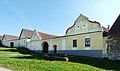
Kočín

Chapel of Saint Procopius in Kočín

Temelín pond

Býšov fortress in Knín

Vysoký Hrádek Castle

Chapel in Temelín


See also[]
- Dukovany, the second Czech municipality with a nuclear power station
References[]
External links[]
| Wikimedia Commons has media related to Temelín. |
| show Authority control |
|---|
This South Bohemian Region location article is a stub. You can help Wikipedia by . |
Categories:
- Villages in České Budějovice District
- South Bohemian Region geography stubs