Hrdějovice
Hrdějovice | |
|---|---|
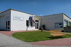 Municipal office | |
 Flag  Coat of arms | |
 Hrdějovice Location in the Czech Republic | |
| Coordinates: 49°1′8″N 14°28′43″E / 49.01889°N 14.47861°ECoordinates: 49°1′8″N 14°28′43″E / 49.01889°N 14.47861°E | |
| Country | |
| Region | South Bohemian |
| District | České Budějovice |
| First mentioned | 1350 |
| Area | |
| • Total | 8.82 km2 (3.41 sq mi) |
| Elevation | 385 m (1,263 ft) |
| Population (2021-01-01)[1] | |
| • Total | 1,558 |
| • Density | 180/km2 (460/sq mi) |
| Time zone | UTC+1 (CET) |
| • Summer (DST) | UTC+2 (CEST) |
| Postal code | 373 61 |
| Website | www |

Hrdějovice (German: Hartowitz) is a municipality and village in České Budějovice District in the South Bohemian Region of the Czech Republic. It has about 1,600 inhabitants.
Hrdějovice lies approximately 5 kilometres (3 mi) north of České Budějovice and 119 km (74 mi) south of Prague.
Administrative parts[]
The village of Opatovice is an administrative part of Hrdějovice.
History[]
The first written mention of Hrdějovice is from 1350 and of Opatovice from 1378. From 1661 to abolition of serfdom in 1850, it belonged to Hluboká manor owned by the Schwarzenberg family.[2]
Sights[]
- Baroque Chapel of the Virgin Mary from the mid-18th century, rebuilt in 1876
- Pilgrimage chapel with a healing well in the local part of Těšín
- Former china clay mine Orty, a natural monument
- Memorial to those killed in World War I
- Folk Baroque style houses
- Memorial to remember the tragic air crash of 18 July 1924
Notable people[]
- František Mareš (1857–1942), physiologist, philosopher and politician
Gallery[]

House No 17

Chapel of the Virgin Mary

One of the tunnels of the Orty mine


References[]
- ^ "Population of Municipalities – 1 January 2021". Czech Statistical Office. 2021-04-30.
- ^ "Historie obce" (in Czech). Obec Hrdějovice. Retrieved 2021-08-29.
External links[]
| Wikimedia Commons has media related to Hrdějovice. |
| show Authority control |
|---|
Categories:
- Villages in České Budějovice District