Olešník
Olešník | |
|---|---|
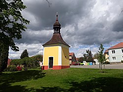 Chapel in the centre | |
 Flag  Coat of arms | |
 Olešník Location in the Czech Republic | |
| Coordinates: 49°6′26″N 14°21′50″E / 49.10722°N 14.36389°ECoordinates: 49°6′26″N 14°21′50″E / 49.10722°N 14.36389°E | |
| Country | |
| Region | South Bohemian |
| District | České Budějovice |
| First mentioned | 1409 |
| Area | |
| • Total | 23.51 km2 (9.08 sq mi) |
| Elevation | 419 m (1,375 ft) |
| Population (2021-01-01)[1] | |
| • Total | 804 |
| • Density | 34/km2 (89/sq mi) |
| Time zone | UTC+1 (CET) |
| • Summer (DST) | UTC+2 (CEST) |
| Postal code | 373 50 |
| Website | www |

Olešník is a municipality and village in České Budějovice District in the South Bohemian Region of the Czech Republic. It has about 800 inhabitants.
Olešník lies approximately 17 kilometres (11 mi) north-west of České Budějovice and 109 km (68 mi) south of Prague.
Administrative parts[]
Villages of Chlumec and Nová Ves are administrative parts of Olešník.
References[]
| Wikimedia Commons has media related to Olešník. |
| Authority control: National libraries |
|---|
This South Bohemian Region location article is a stub. You can help Wikipedia by . |
Categories:
- Villages in České Budějovice District
- South Bohemian Region geography stubs