Horní Radslavice
Horní Radslavice | |
|---|---|
Municipality | |
 | |
 Horní Radslavice | |
| Coordinates: 49°20′21″N 15°53′36″E / 49.33917°N 15.89333°ECoordinates: 49°20′21″N 15°53′36″E / 49.33917°N 15.89333°E | |
| Country | |
| Region | Vysočina |
| District | Žďár nad Sázavou |
| Area | |
| • Total | 4.67 km2 (1.80 sq mi) |
| Elevation | 514 m (1,686 ft) |
| Population (2006) | |
| • Total | 95 |
| • Density | 20/km2 (53/sq mi) |
| Postal code | 594 01 |
| Website | http://www.horniradslavice.cz |

Horní Radslavice is a village and municipality (obec) in Žďár nad Sázavou District in the Vysočina Region of the Czech Republic.
The municipality covers an area of 4.67 square kilometres (1.80 sq mi), and has a population of 95 (as at 2 October 2006).
Horní Radslavice lies approximately 26 kilometres (16 mi) south of Žďár nad Sázavou, 23 km (14 mi) east of Jihlava, and 135 km (84 mi) south-east of Prague.
Gallery[]

Local brook

Municipal office
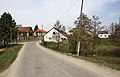
Main street


References[]
| Wikimedia Commons has media related to Horní Radslavice. |
| Authority control: National libraries |
|---|
This Vysočina Region location article is a stub. You can help Wikipedia by . |
Categories:
- Villages in Žďár nad Sázavou District
- Vysočina Region geography stubs