Netín
Netín | |
|---|---|
Municipality | |
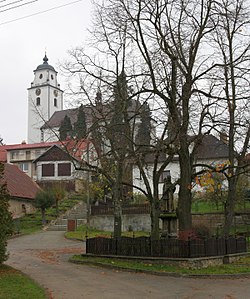 Church of the Assumption of the Virgin Mary | |
 Flag  Coat of arms | |
 Netín | |
| Coordinates: 49°24′44″N 15°57′2″E / 49.41222°N 15.95056°ECoordinates: 49°24′44″N 15°57′2″E / 49.41222°N 15.95056°E | |
| Country | |
| Region | Vysočina |
| District | Žďár nad Sázavou |
| Area | |
| • Total | 7.79 km2 (3.01 sq mi) |
| Elevation | 538 m (1,765 ft) |
| Population (1.1.2013) | |
| • Total | 327 |
| • Density | 42/km2 (110/sq mi) |
| Postal code | 594 44 |
| Website | http://www.obecnetin.cz/ |

Netín is a village and municipality (obec) in Žďár nad Sázavou District in the Vysočina Region of the Czech Republic.
The municipality covers an area of 7.79 square kilometres (3.01 sq mi), and has a population of 325 (as at 28 August 2006).
Netín lies approximately 17 kilometres (11 mi) south of Žďár nad Sázavou, 27 km (17 mi) east of Jihlava, and 134 km (83 mi) south-east of Prague.
References[]
| Wikimedia Commons has media related to Netín. |
| show Authority control |
|---|
This Vysočina Region location article is a stub. You can help Wikipedia by . |
Categories:
- Villages in Žďár nad Sázavou District
- Vysočina Region geography stubs