Kırkağaç
Kırkağaç | |
|---|---|
District | |
 | |
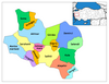
 Location of Kırkağaç within Turkey. | |
 Kırkağaç Location of Kırkağaç | |
| Coordinates: 39°06′N 27°40′E / 39.100°N 27.667°E | |
| Country | |
| Region | Aegean |
| Province | Manisa |
| Area | |
| • District | 549.40 km2 (212.12 sq mi) |
| Elevation | 188 m (617 ft) |
| Population (2012)[2] | |
| • Urban | 25,686 |
| • District | 44,991 |
| • District density | 82/km2 (210/sq mi) |
| Time zone | UTC+2 (EET) |
| • Summer (DST) | UTC+3 (EEST) |
| Postal code | 45xxx |
| Area code(s) | 236 |
| Licence plate | 45 |
| Website | www.kirkagac.bel.tr |

Kırkağaç is a town and district of Manisa Province in the Aegean region of Turkey. According to the 2000 census, population of the district is 48,303 of which 25,093 live in the town of Kırkağaç.[3][4] The district covers an area of 549 km2 (212 sq mi),[5] and the town lies at an elevation of 188 m (617 ft). It has went through under a road reconstruction in late 2021, as well as having gas supply come to the city at the same time with the city of Soma with an ceremony which the Turkish president Recep Tayyip Erdoğan visiting.
Features[]
Kırkağaç is an agricultural district and known for its variety of melon known as Kırkağaç melon (Turkish: Kırkağaç kavunu).
Olive, walnut and almond cultivation is among the important agricultural activities of Kırkağaç.[6] As well as having an clock tower in the center of the city.
Notes[]
- ^ "Area of regions (including lakes), km²". Regional Statistics Database. Turkish Statistical Institute. 2002. Retrieved 2013-03-05.
- ^ "Population of province/district centers and towns/villages by districts - 2012". Address Based Population Registration System (ABPRS) Database. Turkish Statistical Institute. Retrieved 2013-02-27.
- ^ Turkish Statistical Institute. "Census 2000, Key statistics for urban areas of Turkey" (in Turkish). Archived from the original (XLS) on 2007-07-22. Retrieved 2009-04-04.
- ^ GeoHive. "Statistical information on Turkey's administrative units". Archived from the original on 2008-09-25. Retrieved 2009-04-04.
- ^ Statoids. "Statistical information on districts of Turkey". Retrieved 2009-04-04.
- ^ Gazete, Banka (21 November 2021). "Manisalı üreticilere fidan desteği devam ediyor". Gazete Banka. p. https://gazetebanka.com/. Retrieved 21 November 2021.
References[]
- Falling Rain Genomics, Inc. "Geographical information on Kırkağaç, Turkey". Retrieved 2009-04-04.
External links[]
- District governor's official website (in Turkish)
- Road map of Kırkağaç and environs
- Webshots - Image of Kırkağaç Melon Show
- Buy Kirkagac Melon in the UK
Coordinates: 39°06′14″N 27°40′12″E / 39.10389°N 27.67000°E
This article about an Aegean Region of Turkey location is a stub. You can help Wikipedia by . |
- Populated places in Manisa Province
- Districts of Manisa Province
- Aegean Region geography stubs