Kestel, Bursa
Kestel | |
|---|---|
 Kestel | |
| Coordinates: 40°11′37″N 29°12′42″E / 40.19361°N 29.21167°ECoordinates: 40°11′37″N 29°12′42″E / 40.19361°N 29.21167°E | |
| Country | Turkey |
| Province | Bursa |
| Area | |
| • District | 431 km2 (166 sq mi) |
| Population (2012)[2] | |
| • Urban | 38,716 |
| • District | 48,490 |
| • District density | 110/km2 (290/sq mi) |

Kestel is a district of Bursa Province in the Marmara region of Turkey. It is located 14 km east of Bursa city center on the road to Turanköy.
References[]
- ^ "İl ve İlçe Yüzölçümleri" [Provincial and District surface area] (PDF) (in Turkish). Harita Genel Komutanlığı. Retrieved 2013-02-28.
- ^ "Population of province/district centers and towns/villages by districts - 2012". Address Based Population Registration System (ABPRS) Database. Turkish Statistical Institute. Retrieved 2013-02-27.
Kestel, Bursa in Bursa Province of Turkey | |||||||||||||||||||||||||||
|---|---|---|---|---|---|---|---|---|---|---|---|---|---|---|---|---|---|---|---|---|---|---|---|---|---|---|---|
| Districts | 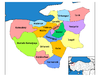 | ||||||||||||||||||||||||||
|
Metropolitan municipalities are bolded. | |||||||||||||||||||||||||||
This geographical article about a location in Bursa Province, Turkey is a stub. You can help Wikipedia by . |
Categories:
- Districts of Bursa Province
- Bursa geography stubs