Khirbat Lid
Lid
خربة لِد العوادين Khirbet Lid al Awadin[1] | |
|---|---|
Village | |
| Etymology: From personal name[2] | |
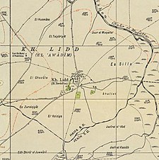 A series of historical maps of the area around Khirbat Lid (click the buttons) | |
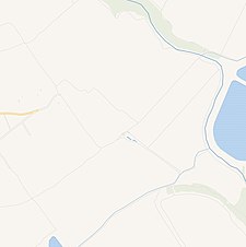
 Lid Location within Mandatory Palestine | |
| Coordinates: 32°36′49″N 35°13′27″E / 32.61361°N 35.22417°ECoordinates: 32°36′49″N 35°13′27″E / 32.61361°N 35.22417°E | |
| Palestine grid | 171/224 |
| Geopolitical entity | Mandatory Palestine |
| Subdistrict | Haifa |
| Date of depopulation | Not known[1] |
| Population (1945) | |
| • Total | 640[3][4] |
| Current Localities | HaYogev[5] |


Lid was a Palestinian village in the Haifa Subdistrict. It was depopulated during the 1948 Arab–Israeli War on April 9, 1948. It was 32 km southeast of Haifa.
History[]
The Khirbat al-Manatir contained artifacts from the Byzantine period.[5]
Ottoman era[]
In 1881, the PEF's Survey of Western Palestine (SWP) found at Ludd "traces of ruins, with a pillar-shaft near a spring."[6]
While surveying for the construction of the Jezreel Valley railway, Gottlieb Schumacher noted in 1900 that Ludd was a "flourishing village" of 46 huts and 200 inhabitants, built up by the Bedouin of the Merj.[7]
British Mandate era[]
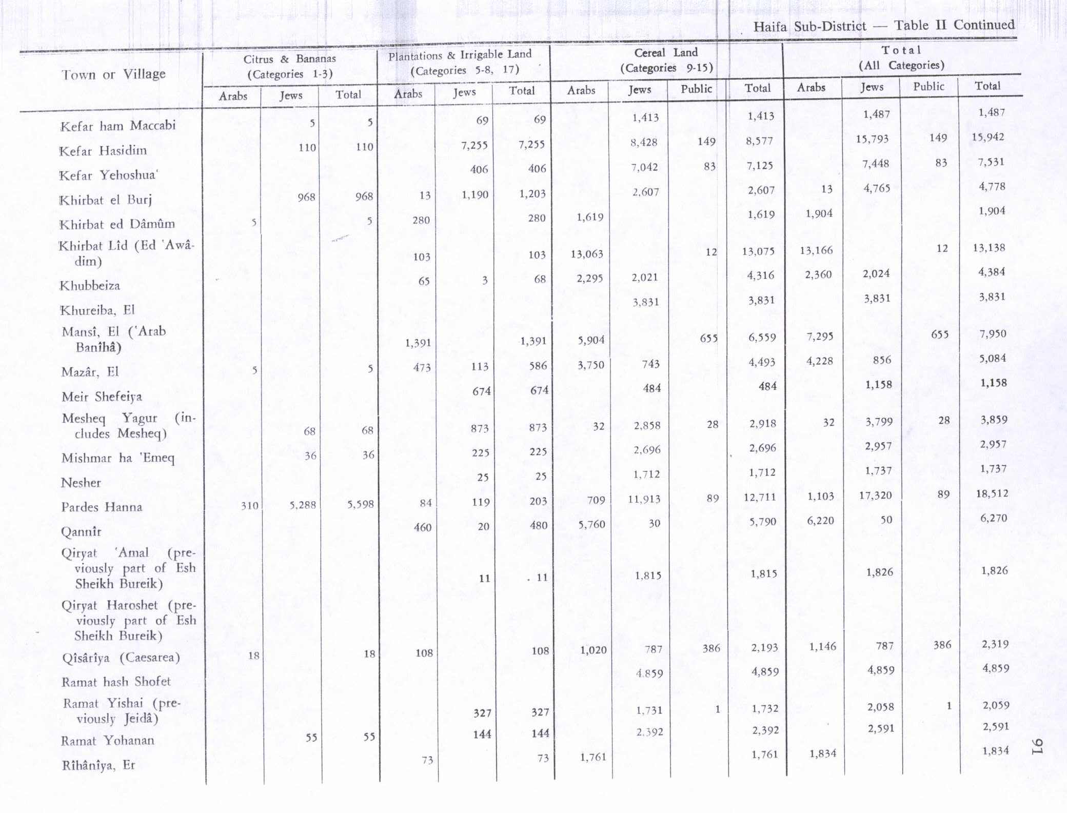
In the 1922 census of Palestine conducted by the British Mandate authorities, the tribal area of Al Awadein had a population of 402 Muslims,[8] increasing in the 1931 census to 451, in 87 houses.[9] In the 1945 statistics it had a population of 640 Muslims,[3] and the total area was 13,572 dunams.[4] Of the land, 103 dunams were used for plantations and irrigable land, 13,063 for cereals,[10] and 52 were built-up (urban) areas.[11]
1948 and aftermath[]
After the war the area was incorporated into the State of Israel. The moshav of HaYogev was established in 1949, west of the village site and partly on village land.[5]
In 1992 the village site was described as "Piles of stones, scattered across the ground near several large eucalyptus and olive trees, are all that remain of the village. There is a newly-built structure over the village well."[5]
References[]
- ^ a b Morris, 2004, p. xviii, village #385. Gives cause of depopulation and date as "Not known"
- ^ Palmer, 1881, p. 151
- ^ a b Department of Statistics, 1945, p. 14
- ^ a b Government of Palestine, Department of Statistics. Village Statistics, April, 1945. Quoted in Hadawi, 1970, p. 48
- ^ a b c d Khalidi, 1992, p. 174
- ^ Conder and Kitchener, 1881, SWP I, p. 66
- ^ Schumacher, 1900, p. 358
- ^ Barron, 1923, Table XI, Sub-district of Haifa, p. 35
- ^ Mills, 1932, p. 94
- ^ Government of Palestine, Department of Statistics. Village Statistics, April, 1945. Quoted in Hadawi, 1970, p. 91
- ^ Government of Palestine, Department of Statistics. Village Statistics, April, 1945. Quoted in Hadawi, 1970, p. 141
Bibliography[]
- Barron, J.B., ed. (1923). Palestine: Report and General Abstracts of the Census of 1922. Government of Palestine.
- Conder, C.R.; Kitchener, H.H. (1881). The Survey of Western Palestine: Memoirs of the Topography, Orography, Hydrography, and Archaeology. 1. London: Committee of the Palestine Exploration Fund.
- Department of Statistics (1945). Village Statistics, April, 1945. Government of Palestine.
- Hadawi, S. (1970). Village Statistics of 1945: A Classification of Land and Area ownership in Palestine. Palestine Liberation Organization Research Center.
- Khalidi, W. (1992). All That Remains: The Palestinian Villages Occupied and Depopulated by Israel in 1948. Washington D.C.: Institute for Palestine Studies. ISBN 0-88728-224-5.
- Mills, E., ed. (1932). Census of Palestine 1931. Population of Villages, Towns and Administrative Areas. Jerusalem: Government of Palestine.
- Morris, B. (2004). The Birth of the Palestinian Refugee Problem Revisited. Cambridge University Press. ISBN 978-0-521-00967-6.
- Palmer, E.H. (1881). The Survey of Western Palestine: Arabic and English Name Lists Collected During the Survey by Lieutenants Conder and Kitchener, R. E. Transliterated and Explained by E.H. Palmer. Committee of the Palestine Exploration Fund.
- Schumacher, G. (1900). "Reports from Galilee". Quarterly Statement - Palestine Exploration Fund. 32 (4): 355–360. doi:10.1179/peq.1900.32.4.355.
External links[]
- Welcome To Lid, Khirbat
- Khirbet Lid (al-'Awwadin), Zochrot
- Survey of Western Palestine, Map 8: IAA, Wikimedia commons
- Lid, khirbat, from the Khalil Sakakini Cultural Center

- Arab villages depopulated during the 1948 Arab–Israeli War
- District of Haifa